Wijken van Sri Lanka
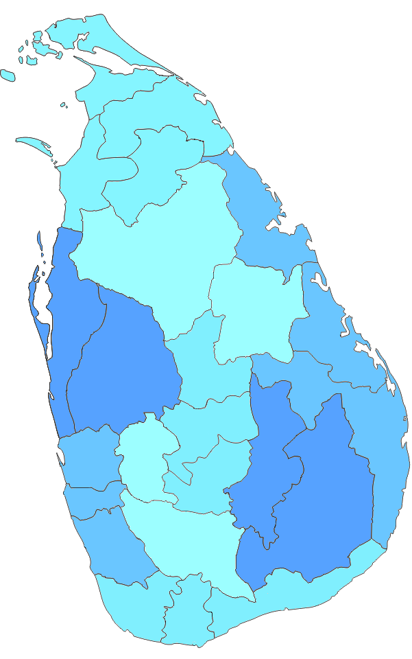
In Sri Lanka zijn districten (Sinhala: දිස්ත්රික්ක, Tamil: மாவட்டம்) de administratieve afdelingen van het tweede niveau. Het eerste niveau zijn de provincies. Elke provincie bevat een aantal districten. Er zijn 25 districten in het land. Ze zij…
In Sri Lanka zijn districten (Sinhala: දිස්ත්රික්ක, Tamil: மாவட்டம்) de administratieve afdelingen van het tweede niveau. Het eerste niveau zijn de provincies. Elke provincie bevat een aantal districten. Er zijn 25 districten in het land. Ze zijn georganiseerd in 9 provincies. Elk district wordt bestuurd door een districtssecretaris. De secretarissen worden benoemd door de centrale regering.
Afbeeldingengalerij
8 Afbeeldingen


Wijken
Alle bevolkingsaantallen zijn afkomstig van de meest recente volkstelling van Sri Lanka, in 2012. De bevolkingsdichtheid is berekend aan de hand van de landoppervlakte in plaats van de totale oppervlakte (de totale oppervlakte zou de oppervlakte van rivieren en meren hebben omvat).
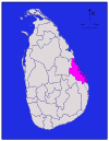
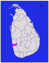
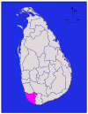
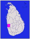
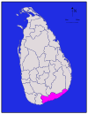
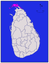
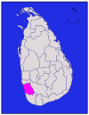
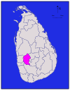
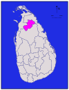
| District | Gebiedskaart | Provincie | District |
|
| Totale | Bevolking |
|
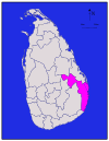
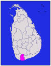
| Ampara |
| Ampara | 4,222 (1,630) | 193 (75) | 4,415 (1,705) | 648,057 | 153 (400) | |
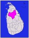
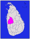
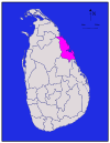
| Anuradhapura |
| Noord Centraal | Anuradhapura | 6,664 (2,573) | 515 (199) | 7,179 (2,772) | 856,232 | 128 (330) |
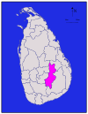
| Badulla |
| Uva | Badulla | 2,827 (1,092) | 34 (13) | 2,861 (1,105) | 811,758 | 287 (740) |
|
| Batticaloa | 2,610 (1,010) | 244 (94) | 2,854 (1,102) | 525,142 | 201 (520) | ||
|
| Western | Colombo | 676 (261) | 23 (8.9) | 699 (270) | 2,309,809 | 3,417 (8,850) | |
| Galle |
| Zuidelijk | Galle | 1,617 (624) | 35 (14) | 1,652 (638) | 1,058,771 | 655 (1,700) |
| Gampaha |
| Western | Gampaha | 1,341 (518) | 46 (18) | 1,387 (536) | 2,294,641 | 1,711 (4,430) |
| Hambantota |
| Zuidelijk | Hambantota | 2,496 (964) | 113 (44) | 2,609 (1,007) | 596,617 | 239 (620) |
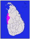
|
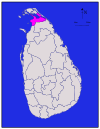
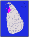
| Noordelijk | 929 (359) | 96 (37) | 1,025 (396) | 583,378 | 628 (1,630) | ||
| Kalutara |
| Western | Kalutara | 1,576 (608) | 22 (8.5) | 1,598 (617) | 1,217,260 | 772 (2,000) |
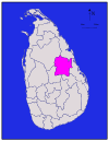
| Kandy |
| Kandy | 1,917 (740) | 23 (8.9) | 1,940 (750) | 1,369,899 | 715 (1,850) | |
| Kegalle |
| Sabaragamuwa | Kegalle | 1,685 (651) | 8 (3.1) | 1,693 (654) | 836,603 | 497 (1,290) |
|
| Noordelijk | Kilinochchi | 1,205 (465) | 74 (29) | 1,279 (494) | 112,875 | 94 (240) | |
| Kurunegala |
| Noordwestelijk | Kurunegala | 4,624 (1,785) | 192 (74) | 4,816 (1,859) | 1,610,299 | 348 (900) |
|
| Noordelijk | Mannar | 1,880 (730) | 116 (45) | 1,996 (771) | 99,051 | 53 (140) | |
| Matale |
| Matale | 1,952 (754) | 41 (16) | 1,993 (770) | 482,229 | 247 (640) | |
| Matara |
| Zuidelijk | Matara | 1,270 (490) | 13 (5.0) | 1,283 (495) | 809,344 | 637 (1,650) |
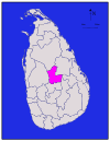
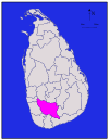
| Moneragala |
| Uva | Moneragala | 5,508 (2,127) | 131 (51) | 5,639 (2,177) | 448,142 | 81 (210) |
|
| Noordelijk | Mullaitivu | 2,415 (932) | 202 (78) | 2,617 (1,010) | 91,947 | 38 (98) | |
| Nuwara Eliya |
| Nuwara Eliya | 1,706 (659) | 35 (14) | 1,741 (672) | 706,588 | 414 (1,070) | |
| Polonnaruwa |
| Noord Centraal | Polonnaruwa | 3,077 (1,188) | 216 (83) | 3,293 (1,271) | 403,335 | 131 (340) |
| Puttalam |
| Noordwestelijk | Puttalam | 2,882 (1,113) | 190 (73) | 3,072 (1,186) | 759,776 | 264 (680) |
| Ratnapura |
| Sabaragamuwa | Ratnapura | 3,236 (1,249) | 39 (15) | 3,275 (1,264) | 1,082,277 | 334 (870) |
|
| Trincomalee | 2,529 (976) | 198 (76) | 2,727 (1,053) | 378,182 | 150 (390) | ||
|
| Noordelijk | Vavuniya | 1,861 (719) | 106 (41) | 1,967 (759) | 171,511 | 92 (240) | |
| Totaal | 62,705 (24,211) | 2,905 (1,122) | 65,610 (25,330) | 20,263,723 | 323 (840) |


Vragen en antwoorden
V: Wat zijn districten in Sri Lanka?
A: In Sri Lanka zijn districten administratieve afdelingen van het tweede niveau.
V: Wat is het eerste niveau van bestuurlijke afdelingen in Sri Lanka?
A: De eerste bestuurslaag in Sri Lanka zijn de provincies.
V: Hoeveel districten zijn er in Sri Lanka?
A: Er zijn 25 districten in Sri Lanka.
V: Hoeveel provincies zijn er in Sri Lanka?
A: Er zijn 9 provincies in Sri Lanka.
V: Wie bestuurt elk district in Sri Lanka?
A: Elk district in Sri Lanka wordt bestuurd door een districtssecretaris.
V: Wie benoemt de districtsecretarissen in Sri Lanka?
A: De centrale overheid benoemt de districtssecretarissen in Sri Lanka.
V: Wat zijn de namen van de administratieve afdelingen in het Singalees en Tamil in Sri Lanka?
A: De administratieve afdelingen in Sri Lanka staan bekend als "දිස්ත්රික්ක" in het Singalees en "மாவட்டம்" in het Tamil.
Gerelateerde artikelen
Auteur
AlegsaOnline.com Wijken van Sri Lanka Leandro Alegsa
URL: https://nl.alegsaonline.com/art/27771
Bronnen
- commons.wikimedia.org : Districts of Sri Lanka
- priu.gov.lk : "At a Glance"
- ds.gov.lk : "Vision & Mission" · web.archive.org
- archives.dailynews.lk : "Kilinochchi a brief look"