Marion County, Kansas
Marion County (standaardafkorting: MN) is een county in de Amerikaanse staat Kansas. In 2010 woonden er 12.660 mensen. De hoofdstad is Marion. De county is vernoemd naar Francis Marion, een brigadegeneraal uit de Amerikaanse Revolutionaire Oorlo…
Marion County (standaardafkorting: MN) is een county in de Amerikaanse staat Kansas. In 2010 woonden er 12.660 mensen. De hoofdstad is Marion. De county is vernoemd naar Francis Marion, een brigadegeneraal uit de Amerikaanse Revolutionaire Oorlog, bekend als de "Swamp Fox".
Afbeeldingengalerij
10 Afbeeldingen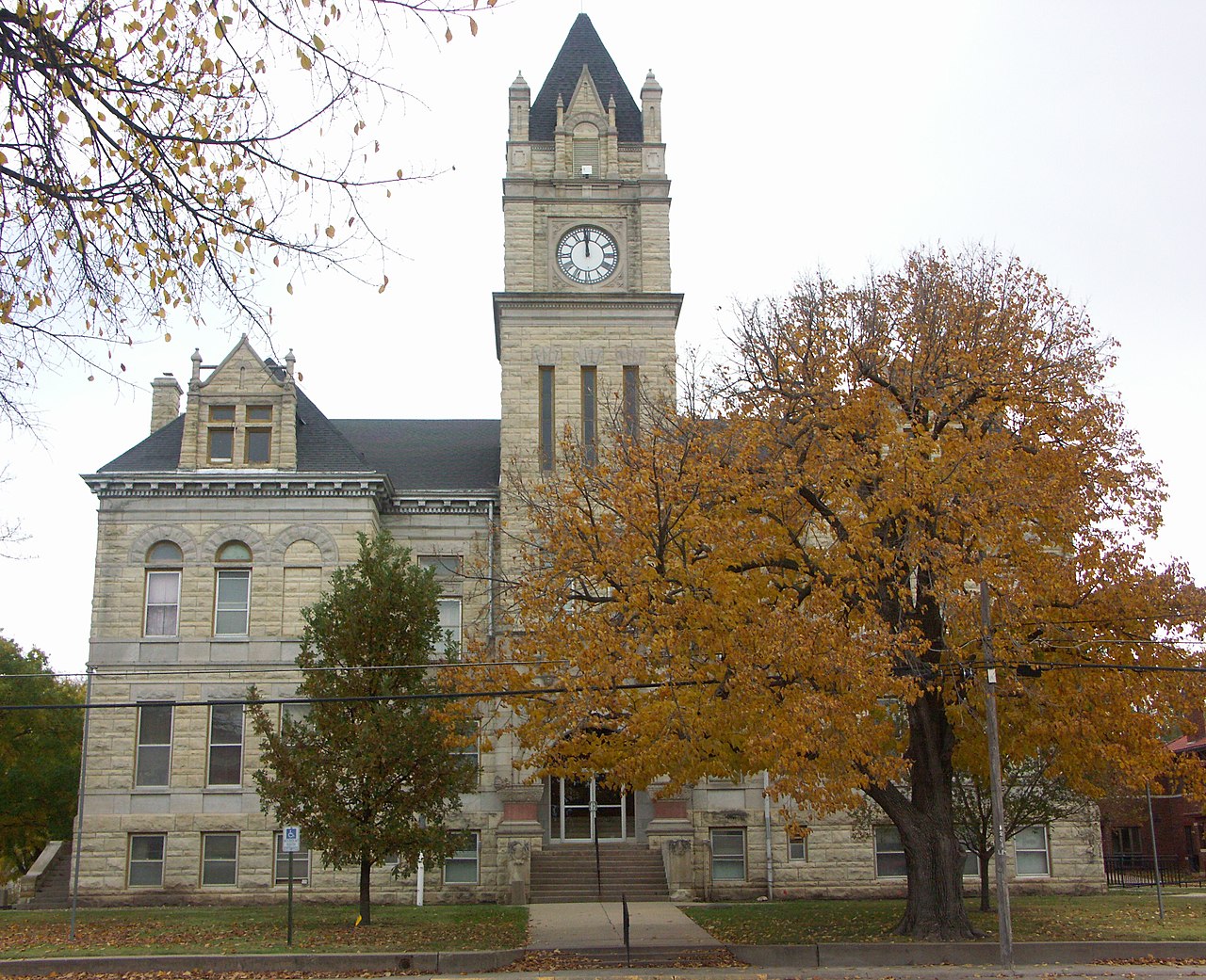


Geschiedenis
21e eeuw
In 2010 werd de Keystone-Cushing Pipeline (fase II) van noord naar zuid door Marion County aangelegd. Er was veel controverse over schade aan de weg, belastingvrijstelling en milieubezwaren (mocht er ooit een lek ontstaan).
Geografie
Volgens het U.S. Census Bureau heeft de county een totale oppervlakte van 954 vierkante mijl (2.470 km2 ). Daarvan is 944 vierkante mijl (2.440 km2 ) land en 9,4 vierkante mijl (24 km2 ) (1,0%) water.
Marion County ligt in de Great Plains. Het oostelijke deel van de county maakt deel uit van de Flint Hills.
Mensen
| Historische bevolking | |||
| Volkstelling | Pop. | %± | |
| 74 | - | ||
| 1870 | 768 | 937.8% | |
| 12,453 | 1,521.5% | ||
| 20,539 | 64.9% | ||
| 1900 | 20,676 | 0.7% | |
| 1910 | 22,415 | 8.4% | |
| 1920 | 22,923 | 2.3% | |
| 1930 | 20,739 | -9.5% | |
| 1940 | 18,951 | -8.6% | |
| 1950 | 16,307 | -14.0% | |
| 1960 | 15,143 | -7.1% | |
| 1970 | 13,935 | -8.0% | |
| 1980 | 13,522 | -3.0% | |
| 1990 | 12,888 | -4.7% | |
| 2000 | 13,361 | 3.7% | |
| 2010 | 12,660 | -5.2% | |
| 2018 (schatting) | 11,950 | -5.6% | |
| Amerikaanse tienjaarlijkse volkstelling | |||

Overheid
Presidentsverkiezingen
Resultaten presidentsverkiezingen
| Resultaten presidentsverkiezingen | |||
| Jaar | Derden | ||
| 2016 | 71.2% 4,003 | 21.4% 1,204 | 7.4% 417 |
| 2012 | 71.9% 3,889 | 25.6% 1,385 | 2.5% 135 |
| 2008 | 68.6% 4,159 | 29.7% 1,801 | 1.6% 99 |
| 2004 | 73.3% 4,516 | 24.9% 1,536 | 1.7% 107 |
| 2000 | 70.4% 4,156 | 25.0% 1,475 | 4.6% 272 |
| 1996 | 65.3% 4,173 | 26.2% 1,673 | 8.5% 543 |
| 1992 | 49.5% 3,142 | 25.6% 1,627 | 24.9% 1,582 |
| 1988 | 63.0% 3,685 | 34.6% 2,024 | 2.4% 141 |
| 1984 | 72.1% 4,407 | 26.7% 1,632 | 1.3% 77 |
| 1980 | 64.4% 3,960 | 25.5% 1,569 | 10.1% 621 |
| 1976 | 50.7% 3,226 | 47.2% 3,004 | 2.0% 130 |
| 1972 | 72.2% 4,373 | 24.4% 1,478 | 3.4% 208 |
| 1968 | 70.4% 4,287 | 24.5% 1,494 | 5.1% 311 |
| 1964 | 54.9% 3,481 | 44.0% 2,792 | 1.1% 68 |
| 1960 | 73.2% 5,250 | 26.6% 1,904 | 0.3% 18 |
| 1956 | 76.0% 5,318 | 23.5% 1,644 | 0.5% 36 |
| 80.2% 6,228 | 17.5% 1,361 | 2.3% 178 | |
| 64.9% 4,724 | 33.2% 2,421 | 1.9% 140 | |
| 1944 | 72.6% 5,219 | 26.8% 1,925 | 0.6% 41 |
| 1940 | 67.4% 5,764 | 31.9% 2,724 | 0.7% 59 |
| 1936 | 49.7% 4,185 | 49.9% 4,207 | 0.4% 34 |
| 1932 | 41.7% 3,220 | 56.6% 4,366 | 1.7% 129 |
| 1928 | 73.5% 5,446 | 26.2% 1,938 | 0.4% 26 |
| 1924 | 56.4% 4,008 | 21.4% 1,520 | 22.2% 1,581 |
| 1920 | 65.8% 3,840 | 29.4% 1,713 | 4.8% 281 |
| 1916 | 52.1% 3,453 | 42.1% 2,790 | 5.7% 379 |
| 1912 | 20.0% 863 | 40.1% 1,732 | 39.9% 1,724 |
| 1908 | 57.5% 2,546 | 39.4% 1,747 | 3.1% 139 |
| 1904 | 71.2% 2,705 | 24.4% 928 | 4.4% 166 |
| 1900 | 59.7% 2,623 | 39.3% 1,729 | 1.0% 44 |
| 56.6% 2,285 | 42.1% 1,699 | 1.3% 53 | |
| 1892 | 55.5% 2,210 | 44.5% 1,749 | |
| 1888 | 60.2% 2,375 | 32.5% 1,283 | 7.4% 290 |
Onderwijs
Geünificeerde schooldistricten
- Centrum USD 397
- Studenten in Lincolnville, Lost Springs, Pilsen, Tampa, Ramona, Antelope, landelijke gebieden.
- Centre High School, in landelijk gebied tussen Lincolnville en Lost Springs
- Peabody-Burns USD 398
- Studenten in Peabody, Burns, Wonsevu, landelijke gebieden
- Peabody-Burns Junior/Senior High School, in Peabody
- Marion USD 408
- Studenten in Marion, Florence, Eastshore, Canada, Aulne, Marion County Lake, landelijke gebieden
- Marion High School, in Marion
- Hillsboro USD 410
- Studenten in Hillsboro, Lehigh, Durham, landelijke gebieden
- Hillsboro High School, in Hillsboro
- Goessel USD 411
- Studenten in Goessel, landelijke gebieden
- Goessel High School, in Goessel
Hogescholen
- Tabor College, in Hillsboro
- Butler Community College (externe campus), in Marion
Gemeenschappen
Steden
- Burns (voorheen bekend als St. Francis)
- Durham (voorheen bekend als Durham Park)
- Florence
- Goessel (voorheen bekend als Gnadenfeld)
- Hillsboro (voorheen bekend als Hill City)
- Lehigh
- Lincolnville
- Verloren bronnen
- Marion (voorheen bekend als Marion Centre)
- Peabody (voorheen bekend als Coneburg)
- Ramona
- Tampa

Meer lezen
Provincie
- Our Nation Called : Marion County Answered - Honoring Our Marion County Kansas Veterans; Hillsboro Free Press; 192 pagina's; 2012.
- The Days of June : Recollections of a Country Sheriff; Tracy Mayes; Leathers Pub; 72 pagina's; 1999; ISBN 978-1890622671.
- Touring Marion County: pioniers, meren en de machtige Santa Fe; Robert Collins; 1993.
- Marion County Kansas : Past and Present; Sondra Van Meter; MB Publishing House; 344 pagina's; 1972; LCCN 72-92041.
- Atlas van Marion County, Kansas: met kaarten, plattegronden van de townships, alfabetische plattelandsgids, geschiedenissen van kerken, etc., families, boerderijen, kerken en foto's van algemeen belang; Tri-Tabula Co; 1971.
- The Early Schools of Marion County Kansas; Wilma Stewart Stallwitz; bevindt zich in Peabody Township Library; 33 pagina's; 1960.
- Picture Story of the Flood Waters in Marion and Vicinity; juli 1951. Dit boek bevat foto's van Marion, Florence en Peabody.
- The Scully Land System in Marion County, Kansas; Homer Socolofsky; Kansas State University; 110 pagina's; 1944/1947.
- World War Roll of Honor : Marion County Kansas 1917-1920; Alexander en Dean; 221 pagina's; 1920.
- Marion County, Kansas; Alex E. Case; 1894.
- Portrait and Biographical Record of Dickinson, Saline, McPherson, and Marion Counties, Kansas; Chapman Bros; 614 pagina's; 1893.
- Handboek van Marion County, Kansas; C.S. Burch Publishing Co; 40 pagina's; 1888.
- Alles over Marion County, Kansas; E.W. Hoch; Marion County Record; 1876.
- Plat Book of Marion County, Kansas; W.W. Hixson & Co; 1928.
- Standaardatlas van Marion County, Kansas; Geo. A. Ogle & Co; 99 pagina's; 1921.
- Standaardatlas van Marion County, Kansas; Geo. A. Ogle & Co; 103 pagina's; 1902.
- Atlas van Marion County, Kansas; Davy Map and Atlas Co; 87 pagina's; 1885.
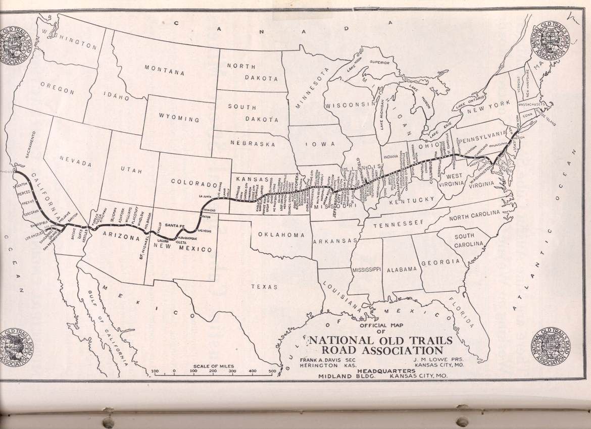
Sporen
- Marion County Auto Tour of the Santa Fe Trail; Cottonwood Crossing Chapter of Santa Fe Trail Association.; 2 pagina's; 2011.
- The Story of the Marking of the Santa Fe Trail by the Daughters of the American Revolution in Kansas and the State of Kansas; Almira Cordry; Crane Co; 164 blz.; 1915.
- The National Old Trails Road To Southern California, Part 1 (LA to KC); Automobile Club Of Southern California; 64 pagina's; 1916.
Mennonitische nederzettingen en kerken
- The Varieties of Kansas German Dialects after 150 Years of German Group Settlement in Kansas, William D. Kell, 2006.
- De Ebenfeldse kerk in actie, 1876-1976.
- 1874 Mennonite Immigration Centennial[ permanent dead link] ; Mennonite Life; Mid-Year 1974.
- De discipelen van Menno Simonis: Their Settlement in Central Kansas[ permanent dead link] ; Frank Leslie's Illustrated; Mennonite Life; September 1999.
- Alexanderwohl Villages in Kansas, 1874 (kaart) Archived 2013-02-16 at the Wayback Machine; P.U. Schmidt; Mennonite Life; October 1949.
- The Alexanderwohl Church Building[ permanent dead link] ; Alvin Gooseen; Mennonite Life; december 1974.
- Impact van de mennonitische nederzetting op het culturele landschap van Kansas; Brenda Martin; Kansas State University; 1985/1988.
- Mennonite settlement : the relationship between the physical and cultural environment; Susan Movle; University of Utah; 1975/1886.
- Status van mennonitische vrouwen in Kansas in hun kerkelijke en huiselijke relaties; Eva Harshbarger; Bluffton College; 1925/1945.
- De discipelen van Menno Simonis: Their Settlement in Central Kansas; Frank Leslie's Illustrirte Zeitung; 20 maart 1875. (Duitse versie van Engels artikel)
- De discipelen van Menno Simonis: Their Settlement in Central Kansas; Frank Leslie's Illustrated; 20 maart 1875. (Engels)
Vragen en antwoorden
V: Wat is de standaardafkorting voor Marion County?
A: De standaardafkorting voor Marion County is MN.
V: Hoeveel mensen woonden er in 2010 in Marion County?
A: In 2010 woonden er 12.660 mensen in Marion County.
V: Wat is de districtszetel van Marion County?
A: De hoofdstad van Marion County is Marion.
V: Wie was Francis Marion?
A: Francis Marion was een brigadegeneraal in de Amerikaanse Revolutionaire Oorlog, bekend als de "Swamp Fox".
V: Waarom is de county genoemd naar Francis Marion?
A: De county werd naar Francis Marion genoemd om zijn dienst tijdens de Amerikaanse Revolutionaire Oorlog te eren.
V: Waar ligt Marion County?
A: Marinon County ligt in de Amerikaanse staat Kansas.
Gerelateerde artikelen
Auteur
AlegsaOnline.com Marion County, Kansas Leandro Alegsa
URL: https://nl.alegsaonline.com/art/62025
Bronnen
- archive.org : The Scully Land System in Marion County, Kansas
- kansasmemory.org : Hand-book of Marion County, Kansas · archive.org · archive.org
- kansasmemory.org : Standard Atlas of Marion County, Kansas
- kansasmemory.org : Standard Atlas of Marion County, Kansas
- kansasmemory.org : Atlas of Marion County, Kansas
- santafetrail.org : Marion County Auto Tour of the Santa Fe Trail · archive.org
- www2.ku.edu : The Varieties of Kansas German Dialects after 150 Years of German Group Settlement in Kansas
- tools.bethelks.edu : 1874 Mennonite Immigration Centennial
- tools.bethelks.edu : The Disciples of Menno Simonis: Their Settlement in Central Kansas
- tools.bethelks.edu : Alexanderwohl Villages in Kansas, 1874 (map)
- tools.bethelks.edu : The Alexanderwohl Church Building