Lijst van provincies in Noord-Dakota
Er zijn 53 counties in de Amerikaanse staat North Dakota. De FIPS-code (Federal Information Processing Standard), die door de regering van de Verenigde Staten wordt gebruikt om staten en districten te identificeren, wordt bij elke vermelding ver…
Er zijn 53 counties in de Amerikaanse staat North Dakota.
De FIPS-code (Federal Information Processing Standard), die door de regering van de Verenigde Staten wordt gebruikt om staten en districten te identificeren, wordt bij elke vermelding vermeld. De code van North Dakota is 38, die in combinatie met een countycode wordt geschreven als 38XXX. De FIPS-code voor elke county verwijst naar de volkstellingsgegevens voor die county.
Afbeeldingengalerij
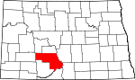
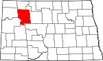
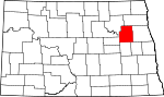
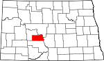
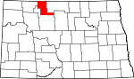
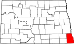
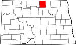
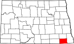
1 Afbeelding

Lijst
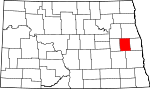
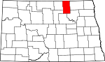
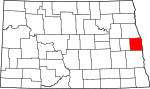
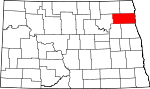
| County | FIPS-code | Provincie zetel | Gevestigd | Betekenis van de naam | Bevolking | Gebied | Kaart |
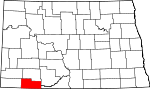
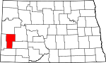
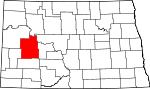
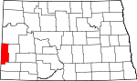
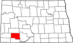
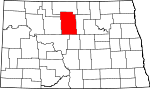
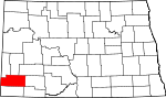
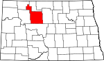
| Adams County | 001 | Hettinger | 1885 | John Quincy Adams, een spoorwegagent en neef van de voormalige president die een belangrijke rol speelde bij de aanleg van de Chicago, Milwaukee en St. Paul Railway door Noord-Dakota. | 7003234300000000000♠2,343 | 700298800000000♠988 sq mi |
|
| Barnes County | 003 | Valley City | 1875 | Dakota Territory rechter Alanson H. Barnes | 7004110660000000000♠11,066 | 7003149200000000000♠1,492 sq mi |
|
| Benson County | 005 | Minnewaukan | 1883 | Dakota territoriale wetgever Bertil W. Benson | 7003666000000000000♠6,660 | 7003138900000000000♠1,389 sq mi |
|
| Billings County | 007 | Medora | 1879 | Frederick H. Billings (1823 - 1890), die president was van de Northern Pacific Railroad | 7002783000000000000♠783 | 70031152000000000♠1,152 sq mi |
|
| Bottineau County | 009 | Bottineau | 1873 | Genoemd naar pionier Pierre Bottineau. | 7003642900000000000♠6,429 | 7003166900000000000♠1,669 sq mi |
|
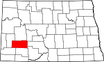
| Bowman County | 011 | Bowman | 1883 | Dakota territoriale wetgever Edward M. Bowman | 7003315100000000000♠3,151 | 70031162000000000♠1,162 sq mi |
|
| Burke County | 013 | Bowbells | 1910 | John Burke, tiende gouverneur van North Dakota | 7003196800000000000♠1,968 | 7003110400000000000♠1,104 sq mi |
|
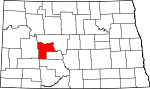
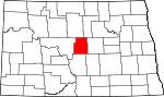
| Burleigh County | 015 | 1873 | Walter A. Burleigh (1820 - 1896), territoriaal afgevaardigde in het Congres | 7004813080000000000♠81,308 | 7003163300000000000♠1,633 sq mi |
| |
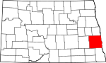
| Cass County | 017 | Fargo | 1873 | George Washington Cass (1810 - 1888), die voorzitter was van de Northern Pacific Railroad | 7005149778000000000♠149,778 | 7003176600000000000♠1,766 sq mi |
|
| Cavalier County | 019 | Langdon | 1873 | Charles Cavalier, Franse pelsjager en een van de oorspronkelijke kolonisten van het gebied. | 7003399300000000000♠3,993 | 7003148900000000000♠1,489 sq mi |
|
| Dickey County | 021 | 1881 | Dakota territoriale wetgever George H. Dickey | 7003528900000000000♠5,289 | 7003113100000000000♠1,131 sq mi |
| |
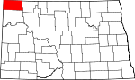
| Divide County | 023 | Crosby | 1910 | Genoemd omdat het ontstond bij de verdeling van Williams County | 7003207100000000000♠2,071 | 7003125900000000000♠1,259 sq mi |
|
| Dunn County | 025 | Manning | 1883 | John P. Dunn, een vroege burgerlijke leider van Bismarck, die de eerste drogisterij in North Dakota opende. | 7003353600000000000♠3,536 | 70032010000000000♠2,010 sq mi |
|
| Eddy County | 027 | New Rockford | 1885 | Ezra B. Eddy, een bankier uit Fargo en een van de rijkste burgers van het gebied... | 7003238500000000000♠2,385 | 70026320000000000♠632 sq mi |
|
| Emmons County | 029 | Linton | 1879 | James Emmons, een vroege ondernemer en zakenman die de eerste stoomboot over de Missouri rivier in Bismarck exploiteerde. | 7003355000000000000♠3,550 | 700315100000000♠1,510 sq mi |
|
| Foster County | 031 | Carrington | 1873 | Ofwel James S. Foster en George I. Foster, broer, en prominente boeren tijdens de territoriale dagen... | 7003334300000000000♠3,343 | 70026350000000000♠635 sq mi |
|
| Golden Valley County | 033 | Strand | 1912 | Genoemd voor promotionele redenen of voor de Golden Valley Land and Cattle Company | 7003168000000000000♠1,680 | 70031002000000000♠1,002 sq mi |
|
| Grand Forks County | 035 | 1873 | Genoemd naar Grand Forks, North Dakota, dat op zijn beurt werd genoemd naar zijn ligging op het kruispunt van de Red Lake River en de Red River of the North. | 7004668610000000000♠66,861 | 7003143800000000000♠1,438 sq mi |
| |
| Grant County | 037 | Carson | 1916 | Ulysses S. Grant (1822 - 1885), achttiende president van de V.S. | 7003239400000000000♠2,394 | 70031660000000000♠1,660 sq mi |
|
| Griggs County | 039 | Cooperstown | 1881 | Alexander Griggs, een stoombootkapitein en stichter van Grand Forks, North Dakota | 7003242000000000000♠2,420 | 70027080000000000♠708 sq mi |
|
| Hettinger County | 041 | Mott | 1883 | Mathias K. Hettinger, de schoonvader van Erastus A. Williams, de voorzitter van het parlement van North Dakota tijdens die zitting. | 7003247700000000000♠2,477 | 7003113200000000000♠1,132 sq mi |
|
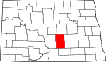
| Kidder County | 043 | Steele | 1873 | Jefferson Parrish Kidder, afgevaardigde in het 44e en 45e Congres. | 7003243500000000000♠2,435 | 70031352000000000♠1,352 sq mi |
|
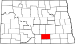
| LaMoure County | 045 | LaMoure | 1873 | Dakota territoriale wetgever en North Dakota staatswetgever Judson LaMoure | 7003413900000000000♠4,139 | 7003114700000000000♠1,147 sq mi |
|
| Logan County | 047 | Napoleon | 1873 | Illinois U.S. Senator John A. Logan (1826 - 1886) | 7003199000000000000♠1,990 | 70029930000000000♠993 sq mi |
|
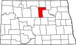
| McHenry County | 049 | Towner | 1873 | James McHenry, een van de oorspronkelijke kolonisten van het gebied | 7003539500000000000♠5,395 | 7003187400000000000♠1,874 sq mi |
|
| McIntosh County | 051 | Ashley | 1883 | Edward H. McIntosh, lid van de Territorial Legislature... | 7003280900000000000♠2,809 | 70029750000000000♠975 sq mi |
|
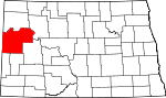
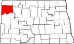
| McKenzie County | 053 | Watford City | 1905 | Alexander McKenzie, partijbaas bekend in de staat als "de senator-maker" | 7003636000000000000♠6,360 | 70032742000000000♠2,742 sq mi |
|
| McLean County | 055 | Washburn | 1883 | John A. McLean, eerste burgemeester van Bismarck, North Dakota | 7003896200000000000♠8,962 | 70032110000000000♠2,110 sq mi |
|
| Mercer County | 057 | Stanton | 1875 | William Henry Harrison Mercer, een vroege kolonist... | 7003842400000000000♠8,424 | 7003104500000000000♠1,045 sq mi |
|
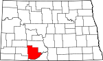
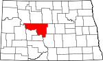
| Morton County | 059 | Mandan | 1873 | Gouverneur van Indiana Oliver Hazard Perry Throck Morton | 7004274710000000000♠27,471 | 7003192600000000000♠1,926 sq mi |
|
| Mountrail County | 061 | Stanley | 1873 | Joseph Mountraille, Metis reiziger en vroege ontdekkingsreiziger | 7003767300000000000♠7,673 | 7003182400000000000♠1,824 sq mi |
|
| Nelson County | 063 | Lakota | 1883 | Dakota territoriale wetgever Nelson E. Nelson | 7003312600000000000♠3,126 | 70029820000000000♠982 sq mi |
|
| Oliver County | 065 | Centrum | 1885 | Dakota territoriale wetgever Harry S. Oliver | 7003184600000000000♠1,846 | 70027240000000000♠724 sq mi |
|
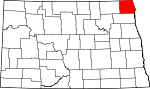
| Pembina County | 067 | Cavalier | 1867 | Genoemd naar de hoge veenbessen die in het gebied in het wild groeiden. Pembina kan afkomstig zijn van een Ojibwa-zin, anepeminan sipi, die verwijst naar de bessen, aangezien die in overvloed groeiden rond de Redberry River; het kan ook afkomstig zijn van een Ojibwa-woord dat ontmoetingsplaats betekent. De naam was oorspronkelijk van toepassing op het oude Pembina Territory | 7003741300000000000♠7,413 | 7003111900000000000♠1,119 sq mi |
|
| Pierce County | 069 | Rugby | 1887 | Gilbert Ashville Pierce, een gouverneur van Dakota Territory en later een U.S. Senator van North Dakota. | 7003435700000000000♠4,357 | 7003101800000000000♠1,018 sq mi |
|
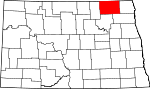
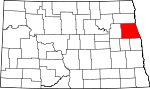
| Ramsey County | 071 | Devils Lake | 1873 | Minnesota U.S. Senator Alexander Ramsey | 7004114510000000000♠11,451 | 7003118600000000000♠1,186 sq mi |
|
| Ransom County | 073 | Lissabon | 1873 | Genoemd naar het plaatselijk gelegen Fort Ransom | 7003545700000000000♠5,457 | 70028630000000000♠863 sq mi |
|
| Renville County | 075 | Mohall | 1873 | Joseph Renville, missionaris en tolk voor Dakota Native Americans | 7003247000000000000♠2,470 | 70028750000000000♠875 sq mi |
|
| Richland County | 077 | Wahpeton | 1873 | Morgan T. Rich, vroege kolonist | 7004163210000000000♠16,321 | 7003143700000000000♠1,437 sq mi |
|
| Rolette County | 079 | Rolla | 1873 | Joseph Rolette, Jr. (1820 - 1871), prominent pelsjager en lokaal politiek organisator. | 7004139370000000000♠13,937 | 700290200000000♠902 sq mi |
|
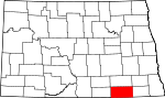
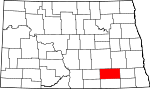
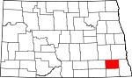
| Sargent County | 081 | Forman | 1883 | Homer E. Sargent, een algemeen directeur van de Northern Pacific Railroad... | 7003382900000000000♠3,829 | 70028590000000000♠859 sq mi |
|
| Sheridan County | 083 | McClusky | 1873 | Amerikaanse Burgeroorlog officier Philip Henry Sheridan (1831 - 1888) | 7003132100000000000♠1,321 | 70029720000000000♠972 sq mi |
|
| Sioux County | 085 | Fort Yates | 1915 | Het Indiaanse Sioux volk | 7003415300000000000♠4,153 | 7003109400000000000♠1,094 sq mi |
|
| Slope County | 087 | Amidon | 1915 | Topografisch kenmerk in de provincie dat bekend staat als de Missouri Slope | 7002727000000000000♠727 | 7003121800000000000♠1,218 sq mi |
|
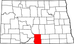
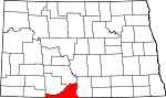
| Stark County | 089 | Dickinson | 1879 | George Stark, een vice-president van de Northern Pacific Railroad... | 7004241990000000000♠24,199 | 7003133800000000000♠1,338 sq mi |
|
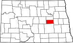
| Steele County | 091 | Finley | 1883 | Edward H. Steele, secretaris-penningmeester van de Red River Land Company... | 7003197500000000000♠1,975 | 70027120000000000♠712 sq mi |
|
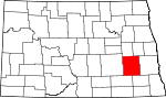
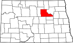
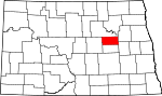
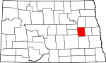
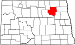
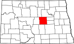
| Stutsman County | 093 | Jamestown | 1873 | Dakota Territorial Wetgever Enos Stutsman | 7004211000000000000♠21,100 | 70032222000000000♠2,222 sq mi |
|
| Towner County | 095 | Cando | 1883 | Dakota territoriale wetgever Oscar M. Towner | 7003224600000000000♠2,246 | 7003102500000000000♠1,025 sq mi |
|
| Traill County | 097 | Hillsboro | 1875 | Walter John Strickland Traill, vroege kolonist | 7003812100000000000♠8,121 | 700286200000000♠862 sq mi |
|
| Walsh County | 099 | Grafton | 1881 | George H. Walsh, vroege kolonist en een van de oprichters van de Universiteit van North Dakota | 7004111190000000000♠11,119 | 7003128200000000000♠1,282 sq mi |
|
| Ward County | 101 | Minot | 1888 | Dakota territoriale wetgever Mark Ward (1844 - 1902) | 7004616750000000000♠61,675 | 7003201300000000000♠2,013 sq mi |
|
| Wells County | 103 | Fessenden | 1873 | Dakota territoriale wetgever Edward Payson Wells | 7003420700000000000♠4,207 | 7003127100000000000♠1,271 sq mi |
|
| Williams County | 105 | Williston | 1890 | Dakota territoriale wetgever Erastus Appelman Williams | 7004223980000000000♠22,398 | 7003207100000000000♠2,071 sq mi |
|


Gerelateerde artikelen
Auteur
AlegsaOnline.com Lijst van provincies in Noord-Dakota Leandro Alegsa
URL: https://nl.alegsaonline.com/art/124625
Bronnen
- itl.nist.gov : "FIPS Publish 6-4"
- epa.gov : "EPA County FIPS Code Listing"
- naco.org : "NACo - Find a county"
- nd.gov : "County History"
- quickfacts.census.gov : "North Dakota QuickFacts"