Lijst van provincies in Zuid Dakota
Er zijn 66 counties in de Amerikaanse staat South Dakota. Todd County en Oglala Lakota County zijn twee county's in South Dakota die geen eigen county seat hebben. Hot Springs in Fall River County is het administratieve centrum van Oglala Lakota…
Er zijn 66 counties in de Amerikaanse staat South Dakota.
Todd County en Oglala Lakota County zijn twee county's in South Dakota die geen eigen county seat hebben. Hot Springs in Fall River County is het administratieve centrum van Oglala Lakota County. Winner in Tripp County is het administratieve centrum van Todd County.
De postale afkorting van South Dakota is SD en de FIPS-staatscode is 46.
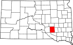
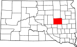
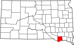
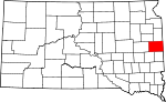
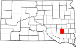
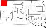
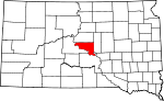
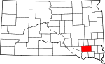
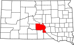
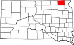
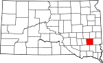
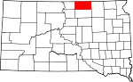
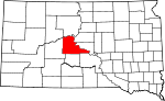
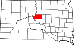
Afbeeldingengalerij
2 Afbeeldingen

Tabel van provincies
| County | FIPS-code | Provincie zetel | Gevestigd | Gevormd uit | Betekenis van de naam | Bevolking | Gebied | Kaart |
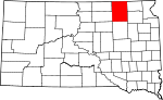
| Aurora County | 003 | Plankinton | 1881 | Cragin en Wetmore counties | Aurora, Romeinse godin van de dageraad | 7003271000000000000♠2,710 | 700270800000000♠708 sq mi |
|
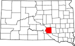
| Beadle County | 005 | Huron | 1879 | Buchard, Clark, Kingsbury, en Spink counties | William Henry Harrison Beadle, hoofd landmeter van Dakota Territory | 7004173980000000000♠17,398 | 7003125900000000000♠1,259 sq mi |
|
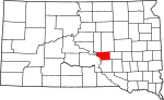
| BennettCounty | 007 | Martin | 1909 | Lugenbeel, Shannon, Washabaugh, en Washington counties | Granville G. Bennett, rechter bij het Hooggerechtshof voor het Dakota Territorium | 7003343100000000000♠3,431 | 7003118500000000000♠1,185 sq mi |
|
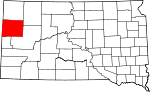
| Bon Homme County | 009 | Tyndall | 1862 | Ongeorganiseerd gebied | Frans woord dat "goede man" betekent | 7003707000000000000♠7,070 | 700256300000000♠563 vierkante mijl |
|
| 011 | Brookings | 1862 | Ongeorganiseerd gebied | Wilmot Brookings (1830 - 1905), rechter in het Hooggerechtshof van Dakota Territory | 7004319650000000000♠31,965 | 7002794000000000000♠794 vierkante mijl |
| |
| Brown County | 013 | Aberdeen | 1879 | Beadle County | Alfred Brown, territoriaal wetgever | 7004365310000000000♠36,531 | 7003171300000000000♠1,713 sq mi |
|
| Brule County | 015 | Chamberlain | 1875 | Charles Mix County | Brulé Sioux Inheemse Amerikanen | 7003525500000000000♠5,255 | 7002819000000000000♠819 sq mi |
|
| BuffaloCounty | 017 | Gann Valley | 1873 | Ongeorganiseerd gebied | Amerikaanse bizon | 7003191200000000000♠1,912 | 7002471000000000000♠471 vierkante mijl |
|
| ButteCounty | 019 | Belle Fourche | 1883 | Harding | Buttes in de regio | 7004101100000000000♠10,110 | 7003224900000000000♠2,249 sq mi |
|
| Campbell County | 021 | Mound City | 1873 | Buffalo | Newton B. Campbell, territoriaal wetgever | 7003146600000000000♠1,466 | 700273600000000♠736 sq mi |
|
| Charles Mix County | 023 | Meer van Andes | 1862 | Ongeorganiseerd gebied | Charles Eli Mix, commissaris van Indianenzaken | 7003912900000000000♠9,129 | 7003109800000000000♠1,098 sq mi |
|
| Clark County | 025 | Clark | 1873 | Hanson | Newton Clark, territoriaal wetgever | 7003369100000000000♠3,691 | 700295800000000♠958 vierkante mijl |
|
| Clay County | 027 | Vermillion | 1862 | Ongeorganiseerd gebied | Henry Clay (1777 - 1852), Amerikaans senator uit Kentucky en prominent politicus in de 19e eeuw | 7004138640000000000♠13,864 | 7002412000000000000♠412 sq mi |
|
| Codington County | 029 | Watertown | 1877 | Indiaanse landen | Eerwaarde G.S. Codington, territoriaal wetgever | 7004272270000000000♠27,227 | 700268800000000♠688 sq mi |
|
| Corson County | 031 | McIntosh | 1909 | Indiaanse landen | Dighton Corson, een rechter van het Hooggerechtshof van South Dakota | 7003405000000000000♠4,050 | 7003247300000000000♠2,473 sq mi |
|
| Custer County | 033 | Custer | 1875 | Indiaanse landen | Generaal George Armstrong Custer (1839 - 1876), sleutelfiguur in de Indiaanse oorlogen | 7003821600000000000♠8,216 | 7003155800000000000♠1,558 sq mi |
|
| Davison County | 035 | Mitchell | 1873 | Hanson | Henry C. Davison, prominent koopman en vroege kolonist | 7004195040000000000♠19,504 | 7002436000000000000♠436 sq mi |
|
| Dag Provincie | 037 | Webster | 1879 | Clark | Merrit H. Day, territoriaal wetgever | 7003571000000000000♠5,710 | 7003102900000000000♠1,029 sq mi |
|
| Deuel County | 039 | Clear Lake | 1862 | Brookings | Jacob S. Deuel, territoriaal wetgever | 7003436400000000000♠4,364 | 700262400000000♠624 sq mi |
|
| Dewey County | 041 | Timber Lake | 1873 | Armstrong County en Indiaans land | William P. Dewey, territoriaal inspecteur-generaal | 7003530100000000000♠5,301 | 7003230300000000000♠2,303 sq mi |
|
| Douglas County | 043 | Pantser | 1873 | Charles Mix | Stephen A. Douglas (1813 - 1861), Amerikaans senator uit Illinois en voorstander van volkssoevereiniteit als middenweg in het slavernijdebat | 7003300200000000000♠3,002 | 7002434000000000000♠434 sq mi |
|
| Edmunds County | 045 | Ipswich | 1873 | Buffalo | Newton Edmunds, gouverneur van Dakota Territory | 7003407100000000000♠4,071 | 7003114600000000000♠1,146 sq mi |
|
| FallRiver County | 047 | Hot Springs | 1883 | Custer | Fall River | 7003709400000000000♠7,094 | 7003174000000000000♠1,740 sq mi |
|
| Faulk County | 049 | Faulkton | 1873 | Niet-georganiseerde landerijen | Andrew Jackson Faulk, gouverneur van Dakota Territory | 7003236400000000000♠2,364 | 700310000000000♠1,000 sq mi |
|
| Grant County | 051 | Milbank | 1873 | Codington en Deuel counties | Ulysses S. Grant (1822 - 1885), Amerikaans president en generaal in de Amerikaanse Burgeroorlog | 7003735600000000000♠7,356 | 700268200000000♠682 vierkante mijl |
|
| Gregory County | 053 | Burke | 1862 | Ongeorganiseerd gebied | John Shaw Gregory, territoriaal wetgever | 7003427100000000000♠4,271 | 7003101600000000000♠1,016 sq mi |
|
| Haakon County | 055 | Philip | 1914 | Stanley County | Koning Haakon VII van Noorwegen | 7003193700000000000♠1,937 | 7003181300000000000♠1,813 sq mi |
|
| Hamlin County | 057 | Hayti | 1873 | Deuel County | HannibalHamlin, vice-president en senator van de Verenigde Staten uit Maine | 7003590300000000000♠5,903 | 7002511000000000000♠511 sq mi |
|
| Hand County | 059 | Miller | 1873 | Buffalo County | George H. Hand, territoriaal wetgever | 7003343100000000000♠3,431 | 7003143700000000000♠1,437 sq mi |
|
| Hanson County | 061 | Alexandria | 1873 | Buffalo en Deuel counties | Joseph R. Hanson, legermajoor in de Indiaanse oorlogen en vroege kolonist | 7003333100000000000♠3,331 | 7002435000000000000♠435 sq mi |
|
| Harding County | 063 | Buffalo | 1909 | Niet-georganiseerde landerijen | J.A. Harding, voorzitter van het Huis voor Dakota Territory | 7003125500000000000♠1,255 | 7003267100000000000♠2,671 sq mi |
|
| Hughes County | 065 | 1880 | Buffalo County | Alexander Hughes, territoriaal wetgever | 7004170220000000000♠17,022 | 700274100000000♠741 sq mi |
| |
| Hutchinson County | 067 | Olivet | 1862 | Ongeorganiseerd gebied | John Hutchinson, territoriaal wetgever | 7003734300000000000♠7,343 | 700281300000000♠813 sq mi |
|
| Hyde County | 069 | Highmore | 1873 | Buffalo County | James Hyde, territoriaal wetgever | 7003142000000000000♠1,420 | 70028610000000000♠861 vierkante mijl |
|
| Jackson County | 071 | Kadoka | 1914 | Stanley County | J.R. Jackson, territoriaal wetgever | 7003303100000000000♠3,031 | 7003186900000000000♠1,869 sq mi |
|
| JerauldCounty | 073 | Wessington Springs | 1883 | Aurora County | H.A. Jerauld, territoriaal wetgever | 7003207000000000000♠2,070 | 7002530000000000000♠530 sq mi |
|
| Jones County | 075 | Murdo | 1916 | Lyman County | George W. Jones, territoriaal wetgever | 7003100600000000000♠1,006 | 700297100000000♠971 sq mi |
|
| KingsburyCounty | 077 | De Smet | 1873 | Hanson County | George W. Kingsbury en T.A. Kingsbury, broers en territoriale wetgevers | 7003514800000000000♠5,148 | 700283800000000♠838 sq mi |
|
| Lake County | 079 | Madison | 1873 | Brookings en Hanson counties | Meren in het graafschap | 7004112000000000000♠11,200 | 700256300000000♠563 vierkante mijl |
|
| Lawrence County | 081 | Deadwood | 1875 | Ongeorganiseerd gebied | John Lawrence (1839 - 1889), territoriaal wetgever | 7004240970000000000♠24,097 | 700280000000000♠800 sq mi |
|
| Lincoln County | 083 | Canton | 1867 | Ongeorganiseerd gebied | Lincoln County, Maine | 7004448280000000000♠44,828 | 7002578000000000000♠578 sq mi |
|
| Lyman County | 085 | Kennebec | 1873 | Ongeorganiseerd gebied | W.P. Lyman, territoriaal wetgever | 7003375500000000000♠3,755 | 700316400000000♠1,640 sq mi |
|
| MarshallCounty | 091 | Britton | 1885 | Dag Provincie | Marshall Vincent, Day County Commissaris | 7003465600000000000♠4,656 | 7002839000000000000♠839 sq mi |
|
| 087 | Salem | 1873 | Hanson County | Edwin McCook, secretaris van Dakota Territory | 7003561800000000000♠5,618 | 7002575000000000000♠575 vierkante mijl |
| |
| McPherson County | 089 | Leola | 1873 | Buffalo County | James B. McPherson (1828 - 1864), generaal in de Burgeroorlog | 7003245900000000000♠2,459 | 7003113700000000000♠1,137 sq mi |
|
| Meade County | 093 | Sturgis | 1889 | Lawrence County | George G. Meade (1815 - 1872), generaal in de Burgeroorlog | 7004254340000000000♠25,434 | 7003347100000000000♠3,471 sq mi |
|
| Mellette County | 095 | Witte Rivier | 1909 | Lyman County | Arthur C. Mellette, eerste gouverneur van South Dakota | 7003204800000000000♠2,048 | 7003130700000000000♠1,307 sq mi |
|
| Miner County | 097 | Howard | 1873 | Hanson County | Nelson Miner en Ephriam Miner, broers en territoriale wetgevers | 7003238900000000000♠2,389 | 7002570000000000000♠570 sq mi |
|
| 099 | Sioux Falls | 1862 | Ongeorganiseerd gebied | Sioux term voor waterval | 7005169468000000000♠169,468 | 700280900000000♠809 sq mi |
| |
| Moody County | 101 | Flandreau | 1873 | Brookings en Minnehaha counties | Gideon C. Moody, voorzitter van het Huis voor Dakota Territory | 7003648600000000000♠6,486 | 7002520000000000000♠520 sq mi |
|
| Oglala Lakota County | 102 | Hot Springs | 1875 | Fall River County | Oglala Lakota stam | 7004135860000000000♠13,586 | 7003209400000000000♠2,094 sq mi |
|
| Pennington County | 103 | 1875 | Ongeorganiseerd gebied | John L. Pennington (1821 - 1900), gouverneur van Dakota Territory | 7005100948000000000♠100,948 | 7003277600000000000♠2,776 sq mi |
| |
| Perkins County | 105 | Bison | 1909 | Butte en Harding counties | Henry E. Perkins, staatssenator | 7003298200000000000♠2,982 | 7003287200000000000♠2,872 sq mi |
|
| Potter County | 107 | Gettysburg | 1875 | Buffalo County | Joel A. Potter, territoriaal wetgever | 7003232900000000000♠2,329 | 700286600000000♠866 vierkante mijl |
|
| Roberts County | 109 | Sisseton | 1883 | Grant County | S.G. Roberts, territoriaal wetgever | 7004101490000000000♠10,149 | 7003110100000000000♠1,101 sq mi |
|
| Sanborn County | 111 | Woonsocket | 1883 | Miner County | George W. Sanborn, president van de Milwaukee Railroad | 7003235500000000000♠2,355 | 700256900000000♠569 sq mi |
|
| Spink County | 115 | Redfield | 1873 | Hanson County | S.L. Spink, Secretaris van Dakota Territory | 7003645100000000000♠6,451 | 7003150400000000000♠1,504 sq mi |
|
| Stanley County | 117 | Fort Pierre | 1873 | Ongeorganiseerd gebied | David S. Stanley, commandant van Fort Sully | 7003296600000000000♠2,966 | 7003144300000000000♠1,443 sq mi |
|
| Sully County | 119 | Onida | 1873 | Potter County | Fort Sully, zelf vernoemd naar Generaal Alfred Sully | 7003137300000000000♠1,373 | 7003100700000000000♠1,007 sq mi |
|
| Todd County | 121 | Winnaar | 1909 | Meyer en Tripp counties | John Blair Smith Todd, territoriaal afgevaardigde naar het Congres | 7003961200000000000♠9,612 | 7003138800000000000♠1,388 sq mi |
|
| Tripp County | 123 | Winnaar | 1873 | Ongeorganiseerd gebied | Bartlett Tripp, opperrechter van het Hooggerechtshof van Dakota Territorial | 7003564400000000000♠5,644 | 7003161400000000000♠1,614 sq mi |
|
| Turner County | 125 | Parker | 1871 | Lincoln County | John W. Turner, territoriaal wetgever | 7003834700000000000♠8,347 | 700261700000000♠617 sq mi |
|
| Union County | 127 | Elk Point | 1862 | Ongeorganiseerd gebied | De unie van de Amerikaanse staten | 7004143990000000000♠14,399 | 7002460000000000000♠460 sq mi |
|
| Walworth County | 129 | Selby | 1873 | Buffalo County | Walworth County, Wisconsin | 7003543800000000000♠5,438 | 700270800000000♠708 sq mi |
|
| Yankton County | 135 | Yankton | 1862 | Ongeorganiseerd gebied | Yankton Sioux Inheemse Amerikanen | 7004224380000000000♠22,438 | 700252200000000♠522 vierkante mijl |
|
| Ziebach County | 137 | Dupree | 1911 | Armstrong, Schnasse, en Sterling counties | Frank M. Ziebach, uitgever en legermajoor tijdens de Indiaanse oorlogen | 7003280100000000000♠2,801 | 7003196200000000000♠1,962 sq mi |
|

Vroegere namen
- Shannon County: omgedoopt tot Oglala Lakota County in 2015
Voormalige provincies
- Armstrong County (1883-1952): Gecreëerd door Dakota Territory als Pyatt County in 1883 uit Cheyenne, Rusk (Dewey), en Stanely Counties. Hernoemd tot Armstrong in 1895. Opgesplitst in Dewey in 1952.
- Boreman County (1873-1909): Gecreëerd door Dakota Territory uit ongeorganiseerde gebieden in 1873. Verloor grondgebied aan North Dakota toen South Dakota in 1889 een staat werd. Eindigde in 1909 toen het deel ging uitmaken van Corson County.
- Lugenbeel County (1875-1909): Gecreëerd door Dakota Territory uit ongeordend land en Meyer en Pratt Counties in 1875. Eindigde in 1909 toen het deel ging uitmaken van Bennett en Todd Counties.
- Nowlin County (1883-1898): Gecreëerd door Dakota Territory in 1883 uit Cheyenne en White River Counties. Eindigde in 1898 toen het een deel werd van Lyman en Stanley Counties.
- Pyatt County (1883-1895): Gecreëerd door Dakota Territory uit ongeorganiseerde gebieden in 1883. Hernoemd tot Armstrong in 1895.
- Schnasse County (1883-1911): Gecreëerd door Dakota Territory uit ongeorganiseerd land en een deel van Boreman County in 1883. Verloor grondgebied aan North Dakota toen South Dakota een staat werd. Eindigde in 1911 toen het een deel werd van Ziebach County.
- Sterling County (1883-1911): Gecreëerd door Dakota Territory uit Cheyenne County. Eindigde in 1911 toen het deel ging uitmaken van Ziebach County.
- Washabaugh County (1883-1983): De meest recente county van South Dakota die werd opgeheven. Gecreëerd door Dakota Territory in 1883. Eindigde in 1983 toen het werd samengevoegd met Jackson County.
- Washington County (1888-1943): Eindigde in 1943 toen het werd samengevoegd met Jackson, Pennington en Shannon Counties.
Gerelateerde artikelen
Auteur
AlegsaOnline.com Lijst van provincies in Zuid Dakota Leandro Alegsa
URL: https://nl.alegsaonline.com/art/124632
Bronnen
- globalindex.com : globalindex.com
- epa.gov : "EPA County FIPS Code Listing"
- naco.org : "NACo - Find a county"
- usatoday.com : "South Dakota"
- historical-county.newberry.org : "Dakota Territory, South Dakota, and North Dakota: Individual County Chronologies"
- historical-county.newberry.org : "South Dakota: Consolidated Chronology of State and County Boundaries"