Lijst van provincies in Pennsylvania
De Commonwealth of Pennsylvania in de Verenigde Staten van Amerika telt zevenenzestig counties. De stad Philadelphia deelt de grenzen met Philadelphia County, en de overheidsfuncties worden sinds 1854 gedeeld.
De Commonwealth of Pennsylvania in de Verenigde Staten van Amerika telt zevenenzestig counties. De stad Philadelphia deelt de grenzen met Philadelphia County, en de overheidsfuncties worden sinds 1854 gedeeld.
Afbeeldingengalerij
2 Afbeeldingen

FIPS-code
De Federal Information Processing Standard (FIPS)-code, die door de regering van de Verenigde Staten wordt gebruikt om provincies op unieke wijze te identificeren, wordt bij elke vermelding vermeld. FIPS-codes zijn getallen van vijf cijfers; voor Pennsylvania beginnen de codes met 42 en worden ze aangevuld met de driecijferige county-code. De FIPS-code voor elk graafschap in de tabel verwijst naar de volkstellingsgegevens voor dat graafschap.
Alfabetische lijst
| County | FIPS-code | Provincie zetel | Gevestigd | Oorsprong | Betekenis van de naam | Bevolking | Gebied | Kaart |
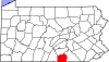
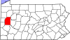
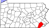
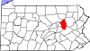
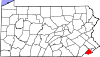
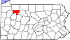
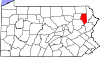
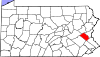
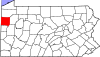
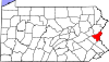
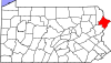
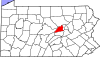
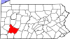
| Adams County | 001 | Gettysburg | 1800 | Delen van York County. | John Adams, tweede president van de V.S. | 7005101407000000000♠101,407 | 70025220000000000♠522 sq mi |
|
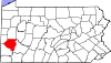
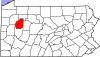
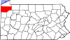
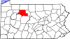
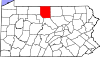
| Allegheny County | 003 | Pittsburgh | 1788 | Delen van Washington en Westmoreland Counties. | Lenape-woord voor de Allegheny-rivier, mogelijk vertaald naar "mooie rivier". | 7006122334800000000♠1,223,348 | 700274500000000♠745 sq mi |
|
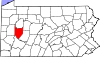
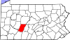
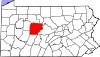
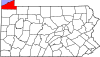
| Armstrong County | 005 | 1800 | Delen van Allegheny, Lycoming, en Westmoreland Counties. | John Armstrong, Revolutionaire Oorlogsgeneraal | 7004689410000000000♠68,941 | 700266400000000♠664 sq mi |
| |
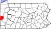
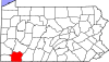
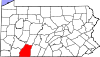
| Beaver County | 007 | Bever | 1800 | Delen van Allegheny en Washington Counties. | Beaver River, zelf genoemd naar het gelijknamige dier dat langs de oevers werd gezien... | 7005170539000000000♠170,539 | 700244400000000♠444 sq mi |
|
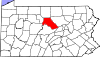
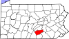
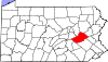
| Bedford County | 009 | Bedford | 1771 | Delen van Cumberland County. | Fort Bedford, dat genoemd is naar John Russell, 4e hertog van Bedford | 7004497620000000000♠49,762 | 7003101500000000000♠1,015 sq mi |
|
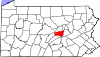
| Berks County | 011 | Lezen | 1752 | Delen van Chester, Lancaster en Philadelphia Counties. | Het Engelse graafschap Berkshire | 7005411442000000000♠411,442 | 70028660000000000♠866 sq mi |
|
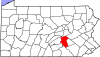
| Blair County | 013 | Hollidaysburg | 1846 | Delen van Huntingdon en Bedford Counties. | John Blair, Pennsylvania staatswetgever | 7005127089000000000♠127,089 | 70025270000000000♠527 sq mi |
|
| Bradford County | 015 | Towanda | 1810 | Delen van Luzerne en Lycoming Counties; heette oorspronkelijk Ontario County, omgedoopt tot Bradford County in 1812. | William Bradford, tweede procureur-generaal van de V.S. | 7004626220000000000♠62,622 | 70031161000000000♠1,161 sq mi |
|
| Bucks County | 017 | Doylestown | 1682 | Een van de oorspronkelijke graafschappen bij de vorming van Pennsylvania | Het Engelse graafschap Buckinghamshire | 7005625249000000000♠625,249 | 70026220000000000♠622 sq mi |
|
| Butler County | 019 | Butler | 1800 | Delen van Allegheny County. | Richard Butler, generaal uit de Revolutionaire Oorlog | 7005183862000000000♠183,862 | 700279500000000♠795 sq mi |
|
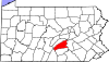
| Cambria County | 021 | Ebensburg | 1804 | Delen van de provincies Somerset en Huntingdon. | Cambria, de traditionele naam voor Wales | 7005143679000000000♠143,679 | 70026930000000000♠693 sq mi |
|
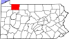
| Cameron County | 023 | Emporium | 1860 | Delen van Clinton, Elk, McKean, en Potter Counties. | Simon Cameron, U.S. Senator uit Pennsylvania... | 7003508500000000000♠5,085 | 70023990000000000♠399 sq mi |
|
| Carbon County | 025 | Jim Thorpe | 1843 | Delen van Monroe en Northampton Counties. | Koolstof, het element dat voorkomt in steenkool | 7004652490000000000♠65,249 | 70023870000000000♠387 sq mi |
|
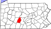
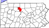
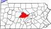
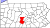
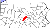
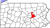
| Centre County | 027 | Bellefonte | 1800 | Delen van Lycoming, Mifflin, Northumberland, en Huntingdon Counties. | Centre Furnace, de eerste industriële faciliteit in het gebied | 7005153990000000000♠153,990 | 7003111200000000000♠1,112 sq mi |
|
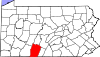
| Chester County | 029 | West Chester | 1682 | Een van de oorspronkelijke graafschappen bij de vorming van Pennsylvania. | De Engelse stad Chester in het graafschap Cheshire | 7005498886000000000♠498,886 | 700276000000000♠760 sq mi |
|
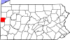
| Clarion County | 031 | Clarion | 1839 | Delen van Venango en Armstrong Counties. | Clarion River, zelf zo genoemd vanwege zijn helderheid | 7004399880000000000♠39,988 | 70026090000000000♠609 sq mi |
|
| Clearfield County | 033 | Clearfield | 1804 | Delen van Lycoming en Huntingdon Counties; Clearfield functioneerde tot 1822 als een deel van Centre County voor gerechtelijke doeleinden. | De gerooide velden van de houtkap in het gebied | 7004816420000000000♠81,642 | 7003115400000000000♠1,154 sq mi |
|
| Clinton County | 035 | Lock Haven | 1839 | Delen van Lycoming en Centre Counties. | DeWitt Clinton, gouverneur van New York en prominent staatsman | 7004392380000000000♠39,238 | 70028980000000000♠898 sq mi |
|
| Columbia County | 037 | Bloomsburg | 1813 | Delen van Northumberland en Luzerne Counties. | Columbia, de eerste populaire en poëtische naam voor de Verenigde Staten | 7004672950000000000♠67,295 | 700249000000000♠490 sq mi |
|
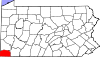
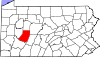
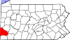
| Crawford County | 039 | Meadville | 1800 | Delen van Allegheny County. | William Crawford, landmeter die hielp het trans-Appalachen gebied open te stellen voor bewoning. | 7004887650000000000♠88,765 | 7003103800000000000♠1,038 sq mi |
|
| Cumberland County | 041 | Carlisle | 1750 | Delen van Lancaster County. | Het historische Engelse graafschap Cumberland | 7005235406000000000♠235,406 | 700255100000000♠551 sq mi |
|
| Dauphin County | 043 | 1785 | Delen van Lancaster County. | Louis-Joseph, kroonprins van Frankrijk | 7005268100000000000♠268,100 | 70025580000000000♠558 sq mi |
| |
| Delaware County | 045 | Media | 1789 | Delen van Chester County. | Delaware rivier, zelf genoemd naar de Delaware stam | 7005558979000000000♠558,979 | 700219100000000♠191 sq mi |
|
| Elk County | 047 | Ridgway | 1843 | Delen van Jefferson, McKean en Clearfield Counties. | Elanden, die de beboste provincie bewonen | 7004319460000000000♠31,946 | 70028320000000000♠832 sq mi |
|
| Erie County | 049 | Erie | 1800 | Delen van Allegheny County; verbonden met Crawford County tot 1803. | 7005280566000000000♠280,566 | 7003155800000000000♠1,558 sq mi |
| |
| Fayette County | 051 | Uniontown | 1783 | Delen van Westmoreland County. | De markies de Lafayette, in Frankrijk geboren generaal uit de Revolutionaire Oorlog. | 7005136606000000000♠136,606 | 70027980000000000♠798 sq mi |
|
| Forest County | 053 | Tionesta | 1848 | Delen van Jefferson County; verbonden met Jefferson County tot 1857. | Belangrijkste natuurlijke kenmerk | 7003771600000000000♠7,716 | 70024310000000000♠431 sq mi |
|
| Franklin County | 055 | Chambersburg | 1784 | Delen van Cumberland County. | Benjamin Franklin, belangrijke grondlegger van de Verenigde Staten | 7005149618000000000♠149,618 | 70027710000000000♠771 sq mi |
|
| Fulton County | 057 | McConnellsburg | 1850 | Delen van Bedford County. | Robert Fulton, uitvinder van de stoomboot | 7004148450000000000♠14,845 | 70024380000000000♠438 sq mi |
|
| Greene County | 059 | Waynesburg | 1796 | Delen van Washington County. | Nathanael Greene, Revolutionaire Oorlogsgeneraal | 7004386860000000000♠38,686 | 70025780000000000♠578 sq mi |
|
| Huntingdon County | 061 | Huntingdon | 1787 | Delen van Bedford County. | Het historische Engelse graafschap Huntingdonshire | 7004459130000000000♠45,913 | 700288900000000♠889 sq mi |
|
| Indiana County | 063 | Indiana | 1803 | Delen van Lycoming en Westmoreland County; het was tot 1806 bij Westmoreland County gevoegd. | Inheemse Amerikanen | 7004888800000000000♠88,880 | 700283400000000♠834 sq mi |
|
| Jefferson County | 065 | Brookville | 1804 | Delen van Lycoming County. Verbonden met Westmoreland County tot 1806 en met Indiana County tot 1830. | Thomas Jefferson, derde president van de V.S. | 7004452000000000000♠45,200 | 70026570000000000♠657 sq mi |
|
| Juniata County | 067 | Mifflintown | 1831 | Delen van Mifflin County. | Juniata-rivier, zelf genoemd naar het Iroquoiaanse woord Onayutta, dat "staande steen" betekent. | 7004246360000000000♠24,636 | 70023940000000000♠394 sq mi |
|
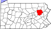
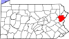
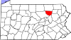
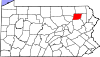
| Lackawanna County | 069 | 1878 | Delen van Luzerne County. | Lackawanna rivier, zelf genoemd naar het Lenape woord dat "stroom die zich splitst" betekent. | 7005214437000000000♠214,437 | 700246500000000♠465 sq mi |
| |
| Lancaster County | 071 | 1729 | Delen van Chester County. | De Engelse stad Lancaster | 7005519445000000000♠519,445 | 70029840000000000♠984 sq mi |
| |
| Lawrence County | 073 | Nieuw Kasteel | 1849 | Delen van Beaver en Mercer Counties. | James Lawrence, kapitein in de oorlog van 1812 | 7004911080000000000♠91,108 | 7002363000000000000♠363 sq mi |
|
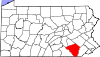
| Lebanon County | 075 | Libanon | 1813 | Delen van Dauphin en Lancaster Counties. | Libanon, de bijbelse term voor "Witte Berg", die verwijst naar de vroomheid van de Moravische stichters van het district. | 7005133568000000000♠133,568 | 7002363000000000000♠363 sq mi |
|
| Lehigh County | 077 | 1812 | Delen van Northampton County. | Lehigh Rivier | 7005349497000000000♠349,497 | 70023490000000000♠349 sq mi |
| |
| Luzerne County | 079 | Wilkes-Barre | 1786 | Delen van Northumberland County. | Anne-César, Chevalier de la Luzerne, Frans ambassadeur in de V.S. die de republikeinse doelen ondersteunde. | 7005320918000000000♠320,918 | 70029070000000000♠907 sq mi |
|
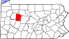
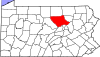
| Lycoming County | 081 | Williamsport | 1795 | Delen van Northumberland County. | Lycoming Creek, zelf genoemd naar het Lenape-woord iacomic dat "grote stoom" betekent. | 7005116111000000000♠116,111 | 7003124400000000000♠1,244 sq mi |
|
| McKean County | 083 | Smethport | 1804 | Delen van Lycoming County; verbonden met Centre County tot 1814 en met Lycoming County tot 1826 voor gerechtelijke en verkiezingsdoeleinden. McKean werd pas in 1826 volledig georganiseerd. | Thomas McKean, tweede gouverneur van Pennsylvania | 7004434500000000000♠43,450 | 70029840000000000♠984 sq mi |
|
| Mercer County | 085 | Mercer | 1800 | Delen van Allegheny County. | Hugh Mercer, Revolutionaire Oorlogsgeneraal | 7005116638000000000♠116,638 | 70026830000000000♠683 sq mi |
|
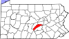
| Mifflin County | 087 | Lewistown | 1789 | Delen van Cumberland en Northumberland Counties. | Thomas Mifflin, eerste gouverneur van Pennsylvania | 7004466820000000000♠46,682 | 70024150000000000♠415 sq mi |
|
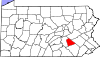
| Monroe County | 089 | Stroudsburg | 1836 | Delen van Pike en Northampton Counties. | James Monroe, vijfde Amerikaanse president | 7005169842000000000♠169,842 | 70026170000000000♠617 sq mi |
|
| Montgomery County | 091 | Norristown | 1784 | Delen van Philadelphia County. | Het historische Welshe graafschap Montgomeryshire of Richard Montgomery, een generaal die sneuvelde in de slag om Quebec in 1775. | 7005799874000000000♠799,874 | 70024870000000000♠487 sq mi |
|
| Montour County | 093 | Danville | 1850 | Delen van Columbia County. | Madame Montour, koloniale ambassadeur bij de Indianen... | 7004182670000000000♠18,267 | 70021320000000000♠132 sq mi |
|
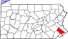
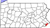
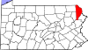
| Northampton County | 095 | Easton | 1752 | Delen van Bucks County. | De Engelse stad Northampton | 7005297735000000000♠297,735 | 70023770000000000♠377 sq mi |
|
| Northumberland County | 097 | Sunbury | 1772 | Delen van Lancaster, Berks, Bedford, Cumberland en Northampton Counties. | Het Engelse graafschap Northumberland | 7004945280000000000♠94,528 | 70024770000000000♠477 sq mi |
|
| Perry County | 099 | New Bloomfield | 1820 | Delen van Cumberland County. | Oliver Hazard Perry, commandant in de oorlog van 1812... | 7004459690000000000♠45,969 | 700255600000000♠556 sq mi |
|
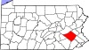
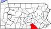
| Philadelphia County | 101 | Philadelphia | 1682 | Een van de oorspronkelijke graafschappen bij de vorming van Pennsylvania. De stad en het graafschap Philadelphia werden in 1854 samengevoegd en de stads- en districtskantoren werden in 1952 samengevoegd. | "Broederliefde" van het Griekse philos ("liefde") en adelphos ("broer"). | 7006152600600000000♠1,526,006 | 7002143000000000000♠143 sq mi |
|
| Pike County | 103 | Milford | 1814 | Delen van Wayne County. | Zebulon Pike, ontdekkingsreiziger van het Amerikaanse Westen | 7004573690000000000♠57,369 | 700256700000000♠567 sq mi |
|
| Potter County | 105 | Coudersport | 1804 | Van Lycoming County. Tot 1826 verbonden met Lycoming County en tot 1835 met McKean County voor juridische doeleinden, werd Potter pas in 1835 volledig georganiseerd. | James Potter, Revolutionaire Oorlogsgeneraal | 7004174570000000000♠17,457 | 7003108100000000000♠1,081 sq mi |
|
| Schuylkill County | 107 | Pottsville | 1811 | Delen van Berks en Northampton Counties. | Schuylkill River, zelf een Nederlandse verbastering van een Lenape-woord dat mogelijk "verborgen rivier" betekent. | 7005148289000000000♠148,289 | 700277800000000♠778 sq mi |
|
| Snyder County | 109 | Middleburg | 1855 | Delen van Union County. | Simon Snyder, derde gouverneur van Pennsylvania | 7004397020000000000♠39,702 | 70023320000000000♠332 sq mi |
|
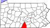
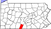
| Somerset County | 111 | Somerset | 1795 | Delen van Bedford County. | Het historische Engelse graafschap Somerset | 7004777420000000000♠77,742 | 7003108100000000000♠1,081 sq mi |
|
| Sullivan County | 113 | Laporte | 1847 | Delen van Lycoming County; verbonden met Lycoming tot 1848. | John Sullivan, Revolutionaire Oorlogsgeneraal | 7003642800000000000♠6,428 | 700245200000000♠452 sq mi |
|
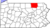
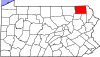
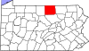
| Susquehanna County | 115 | Montrose | 1810 | Delen van Luzerne County; verbonden met Luzerne County tot 1812. | Susquehanna rivier, zelf genoemd naar een Algonquin woord voor "modderige stroom". | 7004433560000000000♠43,356 | 70028320000000000♠832 sq mi |
|
| Tioga County | 117 | Wellsboro | 1804 | Delen van Lycoming County; verbonden met Lycoming tot 1812. | Tioga rivier, zelf genoemd naar het Lenape woord voor "vorken van de stroom". | 7004419810000000000♠41,981 | 7003113700000000000♠1,137 sq mi |
|
| Union County | 119 | Lewisburg | 1813 | Delen van Northumberland County. | De federale unie van de staten | 7004449470000000000♠44,947 | 700231700000000♠317 sq mi |
|
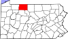
| Venango County | 121 | Franklin | 1800 | Delen van Allegheny en Lycoming Counties; verbonden tot 1805. | Een verbastering van het Lenape woord onenge, wat "otter" betekent. | 7004549840000000000♠54,984 | 70026830000000000♠683 sq mi |
|
| Warren County | 123 | Warren | 1800 | Delen van Allegheny en Lycoming counties; verbonden met Crawford County tot 1805 en vervolgens met Venango totdat Warren in 1819 formeel werd georganiseerd. | Joseph Warren, Revolutionaire Oorlogsgeneraal | 7004418150000000000♠41,815 | 70028980000000000♠898 sq mi |
|
| Washington County | 125 | Washington | 1781 | Delen van Westmoreland County. | George Washington, eerste Amerikaanse president | 7005207820000000000♠207,820 | 700286100000000♠861 sq mi |
|
| Wayne County | 127 | Honesdale | 1798 | Delen van Northampton County. | Anthony Wayne, generaal uit de Revolutionaire Oorlog | 7004528220000000000♠52,822 | 700275100000000♠751 sq mi |
|
| Westmoreland County | 129 | Greensburg | 1773 | Delen van Bedford County. | Het historische Engelse graafschap Westmorland | 7005365169000000000♠365,169 | 7003103600000000000♠1,036 sq mi |
|
| Wyoming County | 131 | Tunkhannock | 1842 | Delen van Luzerne County. | Het Delaware woord xwéːwaməŋk, wat betekent "bij de grote riviervlakte". | 7004282760000000000♠28,276 | 7002405000000000000♠405 sq mi |
|
| York County | 133 | York | 1749 | Delen van Lancaster County. | De Engelse stad York | 7005434972000000000♠434,972 | 700291000000000♠910 sq mi |
|


Gerelateerde artikelen
Auteur
AlegsaOnline.com Lijst van provincies in Pennsylvania Leandro Alegsa
URL: https://nl.alegsaonline.com/art/124629
Bronnen
- epa.gov : "EPA County FIPS Code Listing"
- naco.org : "NACo - Find a county"
- phmc.state.pa.us : "Pennsylvania Counties"
- factfinder.census.gov : "American FactFinder"