Lijst van provincies in Colorado
De Amerikaanse staat Colorado telt in totaal 64 counties. Twee van deze counties, de City and County of Denver en de City and County of Broomfield, hebben een geconsolideerd stads- en provinciebestuur. De postafkorting van Colorado is CO en de F…
De Amerikaanse staat Colorado telt in totaal 64 counties. Twee van deze counties, de City and County of Denver en de City and County of Broomfield, hebben een geconsolideerd stads- en provinciebestuur.
De postafkorting van Colorado is CO en de FIPS-code is 08.
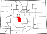
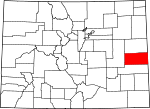
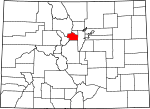
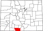
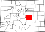
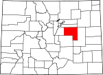
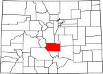
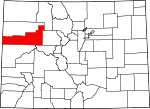
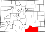
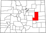
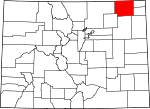
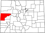
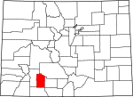
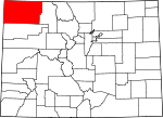
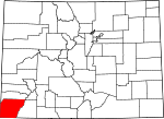
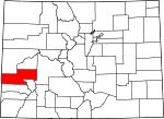
Afbeeldingengalerij
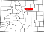
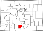
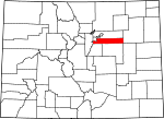
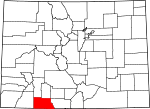
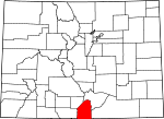
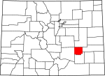
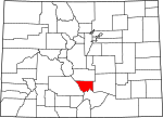
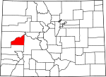
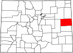
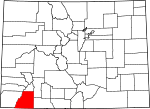
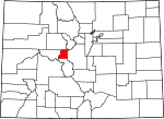
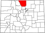
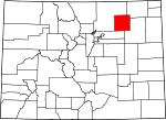
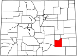
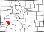
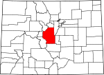
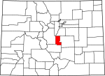
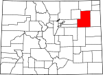
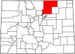
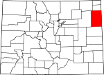
10 Afbeeldingen


Tabel
| County | FIPS-code | Provincie zetel | Gevestigd | Gevormd uit | Betekenis van de naam | Bevolking | Gebied | Kaart | |
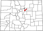
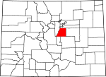
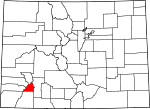
| Adams County | 001 | Brighton | 1902-11-15 | Gesplitst van Arapahoe County. | Genoemd ter ere van Alva Adams, de 5e, 10e en 14e gouverneur van de staat Colorado. | 7005441603000000000♠441,603 | 7003118229000000000♠1,182.29 sq mi |
| |
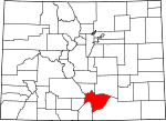
| Alamosa County | 003 | Alamosa | 1913-03-08 | Gesplitst van Costilla County en Conejos County. | Genoemd naar de katoenbomen die langs de Rio Grande en haar zijrivieren groeien. Alamosa is een Spaans woord voor een katoenboomgaard. | 7004154450000000000♠15,445 | 7002723210000000000♠723,21 sq mi |
| |
| Arapahoe County | 005 | Littleton | 1861-11-01 | Gevormd als een van de 17 oorspronkelijke counties van het territorium Colorado. Hernoemd tot South Arapahoe County voor de vijf maanden van 15 november 1902 tot 11 april 1903. | Genoemd naar voorganger Arapahoe County, Kansas Territory, dat op zijn beurt was vernoemd naar de Arapaho Nation of Native Americans. | 7005572003000000000♠572,003 | 7002804410000000000♠804,41 sq mi |
| |
| Archuleta County | 007 | Pagosa Springs | 1885-04-14 | Gesplitst van Conejos County. | Genoemd ter ere van Colorado State Senator Antonio D. Archuleta. | 7004120840000000000♠12,084 | 7003135453000000000♠1,354.53 sq mi |
| |
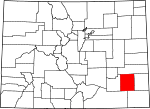
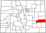
| Baca County | 009 | Springfield | 1889-04-16 | Gesplitst van Las Animas County. | Genoemd ter ere van pionier en Colorado territoriale wetgever Felipe Baca. | 7003378800000000000♠3,788 | 7003255848000000000♠2,558.48 sq mi |
| |
| Bent County | 011 | Las Animas | 1870-02-11 | Gesplitst van Huerfano County en voormalig Cheyenne en Arapaho tribaal land. | Genoemd ter ere van de handelaar William Bent. | 7003649900000000000♠6,499 | 7003154107000000000♠1,541.07 sq mi |
| |
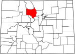
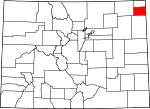
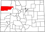
| Boulder County | 013 | 1861-11-01 | Opgericht als een van de 17 oorspronkelijke graafschappen van het territorium Colorado. | Genoemd naar de overvloed aan granieten keien langs Boulder Creek. | 7005294567000000000♠294,567 | 700274048000000♠740,48 sq mi |
| ||
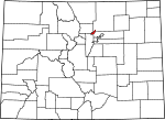
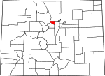
| Broomfield County | 014 | Broomfield | 2001-11-15 | Gesplitst van Boulder, Adams, Jefferson en Weld counties en gereorganiseerd als een geconsolideerde stad en county. | Genoemd naar de bezemmaïs die vroeger in het gebied werd verbouwd. | 7004558890000000000♠55,889 | 7001335700000000000♠33,57 sq mi |
| |
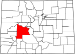
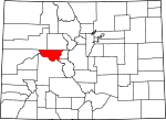
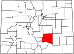
| Chaffee County | 015 | Salida | 1879-02-10 | Gesplitst van Carbonate County. | Genoemd ter ere van Jerome B. Chaffee, een van Colorado's eerste twee Amerikaanse senatoren van 1876 tot 1879. | 7004178090000000000♠17,809 | 7003101412000000000♠1,014.12 sq mi |
| |
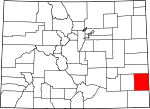
| Cheyenne County | 017 | Cheyenne Wells | 1889-03-25 | Gesplitst van Elbert en Bent counties. | Genoemd naar de Cheyenne Nation of Native Americans. | 7003183600000000000♠1,836 | 700317819000000♠1,781.90 sq mi |
| |
| Clear Creek County | 019 | Georgetown | 1861-11-01 | Opgericht als een van de 17 oorspronkelijke graafschappen van het territorium Colorado. | Genoemd naar Clear Creek die in de provincie ontspringt. | 7003908800000000000♠9,088 | 70023965399900000♠396,53 sq mi |
| |
| Conejos County | 021 | Conejos | 1861-11-01 | Guadalupe County, een van de 17 oorspronkelijke counties van het Territorium Colorado, werd op 7 november 1861 na zes dagen omgedoopt tot Conejos County. | Genoemd naar de katoenstaart konijnen in het gebied. Conejos is een Spaans woord voor konijnen. | 7003825600000000000♠8,256 | 7003129022000000000♠1,290.22 sq mi |
| |
| Costilla County | 023 | San Luis | 1861-11-01 | Opgericht als een van de 17 oorspronkelijke graafschappen van het territorium Colorado. | Genoemd naar de Costilla rivier. Costilla is een Spaans woord dat ribstuk of spant betekent. | 7003352400000000000♠3,524 | 7003122938000000000♠1,229.38 sq mi |
| |
| Crowley County | 025 | Ordway | 1911-05-29 | Gesplitst van Otero County. | Genoemd ter ere van Colorado State Senator John H. Crowley. | 7003582300000000000♠5,823 | 700280027000000♠800,27 sq mi |
| |
| Custer County | 027 | Westcliffe | 1877-03-09 | Gesplitst van Fremont County. | Genoemd ter ere van George Armstrong Custer, (1839 - 1876), de kolonel van het Amerikaanse leger die werd verslagen en gedood in de Slag bij Little Bighorn. | 7003425500000000000♠4,255 | 700273924000000♠739,24 sq mi |
| |
| Delta County | 029 | Delta | 1883-02-11 | Gesplitst van Gunnison County. | Genoemd naar de stad Delta aan de delta van de Uncompahgre rivier. | 7004309520000000000♠30,952 | 7003114944000000000♠1,149.44 sq mi |
| |
| Denver County | 031 | 1902-11-15 | De oorspronkelijke zetel van Arapahoe County werd afgesplitst van Arapahoe County en gereorganiseerd als een geconsolideerde stad en county. | Genoemd ter ere van James W. Denver, gouverneur van het territorium Kansas van 1857 tot 1859. | 7005600158000000000♠600,158 | 700215566000000♠155,66 sq mi |
| ||
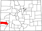
| Dolores County | 033 | Dove Creek | 1881-03-04 | Gesplitst van Ouray County. | Genoemd naar de Dolores Rivier, die oorspronkelijk el Rio de Nuestra Senora de los Dolores heette, wat Spaans is voor de Rivier van Onze Lieve Vrouw van Smarten. | 7003206400000000000♠2,064 | 7003107693000000000♠1,076.93 sq mi |
| |
| Douglas County | 035 | Castle Rock | 1861-11-01 | Opgericht als een van de 17 oorspronkelijke graafschappen van het territorium Colorado. | Genoemd ter ere van Stephen A. Douglas, (1813 - 1861), Amerikaans senator uit Illinois van 1847 tot 1861. | 7005285465000000000♠285,465 | 7002842300000000000♠842,30 sq mi |
| |
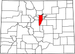
| Eagle County | 037 | Eagle | 1883-02-11 | Gesplitst van Summit County. | Genoemd naar de Eagle River die in de provincie ontspringt. | 7004521970000000000♠52,197 | 7003170076000000000♠1,700.76 sq mi |
| |
| El Paso County | 041 | Colorado Springs | 1861-11-01 | Opgericht als een van de 17 oorspronkelijke graafschappen van het territorium Colorado. | Genoemd naar Ute Pass in de provincie. El paso is een Spaanse uitdrukking voor de pas. | 7005622263000000000♠622,263 | 700321286000000♠2,128.60 sq mi |
| |
| Elbert County | 039 | Kiowa | 1874-02-02 | Gesplitst van Douglas County. | Genoemd ter ere van Samuel Hitt Elbert, de zesde gouverneur van het territorium Colorado. | 7004230860000000000♠23,086 | 7003184908000000000♠1,849.08 sq mi |
| |
| Fremont County | 043 | Cañon City | 1861-11-01 | Opgericht als een van de 17 oorspronkelijke graafschappen van het territorium Colorado. | Genoemd ter ere van John C. Frémont (1813 - 1890), de ontdekkingsreiziger, generaal van het Amerikaanse leger en senator van Californië. | 7004468240000000000♠46,824 | 7003153309000000000♠1,533.09 sq mi |
| |
| Garfield County | 045 | Glenwood Springs | 1883-02-10 | Gesplitst van Summit County. | Genoemd ter ere van James A. Garfield (1831 - 1881), de twintigste president van de Verenigde Staten. | 7004563890000000000♠56,389 | 7003295823000000000♠2,958.23 sq mi |
| |
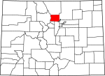
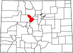
| Gilpin County | 047 | Centrale Stad | 1861-11-01 | Opgericht als een van de 17 oorspronkelijke graafschappen van het territorium Colorado. | Genoemd ter ere van William Gilpin, de eerste gouverneur van het territorium Colorado. | 7003544100000000000♠5,441 | 700215015000000♠150,15 sq mi |
| |
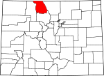
| Grand County | 049 | Hete zwavelbronnen | 1874-02-02 | Gesplitst van Summit County. | Genoemd naar de Grand River die in de provincie ontspringt. De Grand River werd in 1921 omgedoopt tot de Colorado River, maar het graafschap behoudt de oorspronkelijke naam. | 7004148430000000000♠14,843 | 7003186853000000000♠1,868.53 sq mi |
| |
| Gunnison County | 051 | Gunnison | 1877-03-09 | Gesplitst van Lake County. | Genoemd ter ere van John W. Gunnison, de Amerikaanse legerkapitein die de regio verkende. | 7004153240000000000♠15,324 | 7003325922000000000♠3,259.22 sq mi |
| |
| Hinsdale County | 053 | Lake City | 1874-02-10 | Gesplitst in Lake, Conejos en Costilla counties. | Genoemd ter ere van George Aaron Hinsdale, een luitenant-gouverneur van het territorium Colorado. | 7002843000000000000♠843 | 7003112335000099999♠1,123.35 sq mi |
| |
| Huerfano County | 055 | Walsenburg | 1861-11-01 | Opgericht als een van de 17 oorspronkelijke graafschappen van het territorium Colorado. | Genoemd naar Huerfano Butte, een eenzame vulkaanplug. Huerfano is een Spaans woord dat wees betekent. | 7003671100000000000♠6,711 | 7003159237000000000♠1,592.37 sq mi |
| |
| Jackson County | 057 | Walden | 1909-05-05 | Gesplitst van Larimer County. | Genoemd ter ere van Andrew Jackson (1767 - 1845), de zevende president van de Verenigde Staten. | 7003139400000000000♠1,394 | 7003161975000000000♠1,619.75 sq mi |
| |
| Jefferson County | 059 | Gouden | 1861-11-01 | Opgericht als een van de 17 oorspronkelijke graafschappen van het territorium Colorado. | Genoemd naar zijn extralegale voorganger county, Jefferson County, Jefferson Territory, die op zijn beurt werd genoemd ter ere van Thomas Jefferson (1743 - 1826), de auteur van de Onafhankelijkheidsverklaring en de derde president van de Verenigde Staten. | 7005534543000000000♠534,543 | 700277285000000♠772,85 sq mi |
| |
| Kiowa County | 061 | Eads | 1889-04-11 | Gesplitst van Bent County. | Genoemd naar de Kiowa Nation of Native Americans. | 7003139800000000000♠1,398 | 700317859000000♠1,785.90 sq mi |
| |
| Kit Carson County | 063 | Burlington | 1889-04-11 | Gesplitst van Elbert County. | Genoemd ter ere van Christopher Houston "Kit" Carson, de beroemde grensverkenner en soldaat. | 7003827000000000000♠8,270 | 7003216243000099999♠2.162,43 sq mi |
| |
| La Plata County | 067 | Durango | 1874-02-10 | Gesplitst van Lake en Conejos counties. | Genoemd naar de vele zilverafzettingen in het gebied. La plata is een Spaanse uitdrukking voor het zilver. | 7004513340000000000♠51,334 | 7003170044000000000♠1,700.44 sq mi |
| |
| Lake County | 065 | Leadville | 1861-11-01 | Opgericht als een van de 17 oorspronkelijke graafschappen van het Territorium Colorado. Hernoemd tot Carbonate County voor de twee dagen van 8-10 februari 1879. | Genoemd naar de tweelingmeren in de provincie. | 7003731000000000000♠7,310 | 700238355000000♠383,55 sq mi |
| |
| Larimer County | 069 | Fort Collins | 1861-11-01 | Opgericht als een van de 17 oorspronkelijke graafschappen van het territorium Colorado. | Genoemd ter ere van William Larimer, een pionierende ondernemer. | 7005299630000000000♠299,630 | 7003263175000000000♠2,631.75 sq mi |
| |
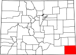
| Las Animas County | 071 | Trinidad | 1866-02-09 | Gesplitst van Huerfano County. | Genoemd naar de Animas rivier, die oorspronkelijk el Rio de las Animas Perdidas heette, wat Spaans is voor de Rivier van de Zielen in het Vagevuur. | 7004155070000000000♠15,507 | 7003477327000000000♠4,773.27 sq mi |
| |
| Lincoln County | 073 | Hugo | 1889-04-11 | Gesplitst van Elbert en Bent counties. | Genoemd ter ere van Abraham Lincoln (1809 - 1865), de zestiende president van de Verenigde Staten. | 7003546700000000000♠5,467 | 7003258521000000000♠2,585.21 sq mi |
| |
| Logan County | 075 | Sterling | 1887-02-25 | Gesplitst van Weld County. | Genoemd ter ere van John A. Logan (1826 - 1886), een Amerikaanse legergeneraal en Amerikaanse senator uit Illinois. | 7004227090000000000♠22,709 | 7003184531000000000♠1,845.31 sq mi |
| |
| Mesa County | 077 | Grand Junction | 1883-02-14 | Gesplitst van Gunnison County. | Genoemd naar de mesa formaties die overal in het gebied voorkomen. | 7005146723000000000♠146,723 | 7003334569000000000♠3.345,69 sq mi |
| |
| Mineral County | 079 | Creede | 1893-03-27 | Gesplitst in Hinsdale, Rio Grande en Saguache counties. | Genoemd naar de overvloedige minerale afzettingen in het gebied. | 7002712000000000000♠712 | 700287816000000♠878,16 sq mi |
| |
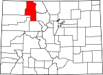
| Moffat County | 081 | Craig | 1911-02-27 | Gesplitst van Routt County. | Genoemd ter ere van spoorwegpionier David H. Moffat. | 7004137950000000000♠13,795 | 7003475586000099999♠4,755.86 sq mi |
| |
| Montezuma County | 083 | Cortez | 1889-04-16 | Gesplitst van La Plata County. | Genoemd ter ere van de Azteekse leider Moctezuma II. Ruïnes in het gebied werden ooit verondersteld Azteeks te zijn. | 7004255350000000000♠25,535 | 7003203580000000000♠2,035.80 sq mi |
| |
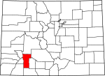
| Montrose County | 085 | Montrose | 1883-02-11 | Gesplitst van Gunnison County. | Genoemd naar de stad Montrose, die op haar beurt waarschijnlijk is vernoemd naar de roman A Legend of Montrose, gepubliceerd in 1819 door Walter Scott. | 7004412760000000000♠41,276 | 7003224643000099999♠2,246.43 sq mi |
| |
| Morgan County | 087 | Fort Morgan | 1889-02-19 | Gesplitst van Weld County. | Genoemd naar het oude Fort Morgan, dat op zijn beurt werd genoemd naar kolonel Christopher A. Morgan van het Amerikaanse leger. | 7004281590000000000♠28,159 | 7003129383000000000♠1,293.83 sq mi |
| |
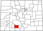
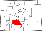
| Otero County | 089 | La Junta | 1889-03-25 | Gesplitst van Bent County. | Genoemd ter ere van Miguel A. Otero van de vooraanstaande Otero-familie uit het zuidwesten. | 7004188310000000000♠18,831 | 7003126766000000000♠1,267.66 sq mi |
| |
| Ouray County | 091 | Ouray | 1877-01-18 | Gesplitst van Hinsdale en Lake counties. Hernoemd tot Uncompaghre County voor vier dagen van 1883-02-27, tot 1883-03-02. | Genoemd naar Ouray, een leider van de Ute. | 7003443600000000000♠4,436 | 7002542290000099999♠542,30 sq mi |
| |
| Park County | 093 | Fairplay | 1861-11-01 | Opgericht als een van de 17 oorspronkelijke graafschappen van het territorium Colorado. | Genoemd naar South Park dat het grootste deel van de provincie beslaat. | 7004162060000000000♠16,206 | 7003220936000000000♠2,209.36 sq mi |
| |
| Phillips County | 095 | Holyoke | 1889-03-27 | Gesplitst van Logan County. | Genoemd ter ere van R.O. Phillips, secretaris van de Lincoln Land Company, die boerderijen in het gebied verkocht. | 7003444200000000000♠4,442 | 7002688300000000000♠688,30 sq mi |
| |
| Pitkin County | 097 | Aspen | 1881-02-23 | Gesplitst van Gunnison County. | Genoemd ter ere van Frederick Walker Pitkin, de tweede gouverneur van de staat Colorado. | 7004171480000000000♠17,148 | 700297037000000♠970,37 sq mi |
| |
| Prowers County | 099 | Lamar | 1889-04-11 | Gesplitst van Bent County. | Genoemd ter ere van John W. Prowers, een pionier van de Arkansas River vallei. | 7004125510000000000♠12,551 | 7003164537000000000♠1,645.37 sq mi |
| |
| Pueblo County | 101 | Pueblo | 1861-11-01 | Opgericht als een van de 17 oorspronkelijke graafschappen van het territorium Colorado. | Genoemd naar de historische stad Pueblo. Pueblo is een Spaans woord dat dorp of volk betekent. | 7005159063000000000♠159,063 | 7003239677000000000♠2,396.77 sq mi |
| |
| Rio Blanco County | 103 | Meeker | 1889-03-25 | Gesplitst van Garfield County. | Genoemd naar de Witte Rivier, die oorspronkelijk Rio Blanco heette in het Spaans. | 7003666600000000000♠6,666 | 7003322624000000000♠3,226.24 sq mi |
| |
| Rio Grande County | 105 | Del Norte | 1874-02-10 | Gesplitst van Costilla County en Conejos County. | Genoemd naar de Rio Grande, die door het gebied stroomt. | 7004119820000000000♠11,982 | 7002913100000000000♠913,10 sq mi |
| |
| Routt County | 107 | Steamboat Springs | 1877-01-29 | Gesplitst van Grand County. | Genoemd ter ere van John Long Routt, de eerste gouverneur van de staat Colorado. | 7004235090000000000♠23,509 | 7003236211000000000♠2,362.11 sq mi |
| |
| Saguache County | 109 | Saguache | 1866-12-29 | Gesplitst van Lake en Costilla counties. | De naam komt van een Ute-taalwoord dat "blauwe aarde" of "water bij blauwe aarde" betekent. | 7003610800000000000♠6,108 | 7003316832000000000♠3.168,32 sq mi |
| |
| San Juan County | 111 | Silverton | 1876-01-31 | Gesplitst van Lake County. | Genoemd naar de San Juan rivier en de San Juan bergen, die op hun beurt zijn vernoemd naar Sint Jan de Evangelist. | 7002699000000000000♠699 | 700238899000000♠388,99 sq mi |
| |
| San Miguel County | 113 | Telluride | 1883-03-02 | Gesplitst van San Juan County. | Genoemd naar de San Miguel rivier en de San Miguel bergen, die op hun beurt zijn vernoemd naar Sint Michael de Aartsengel. | 7003735900000000000♠7,359 | 7003129076000000000♠1,290.76 sq mi |
| |
| Sedgwick County | 115 | Julesburg | 1889-04-09 | Gesplitst van Logan County. | Genoemd naar Fort Sedgwick, dat op zijn beurt is vernoemd naar U.S. Army General John Sedgwick (1813 - 1864). | 7003237900000000000♠2,379 | 7002548830000000000♠548,83 sq mi |
| |
| Summit County | 117 | Breckenridge | 1861-11-01 | Opgericht als een van de 17 oorspronkelijke graafschappen van het territorium Colorado. | Genoemd naar de vele hoge bergtoppen in het gebied. | 7004279940000000000♠27,994 | 7002618910000000000♠618,92 sq mi |
| |
| Teller County | 119 | Cripple Creek | 1899-03-23 | Gesplitst van El Paso en Fremont counties. | Genoemd ter ere van Henry Moore Teller, een Amerikaanse senator uit Colorado en minister van Binnenlandse Zaken van de Verenigde Staten. | 7004233500000000000♠23,350 | 7002558580000000000♠558,58 sq mi |
| |
| Washington County | 121 | Akron | 1887-02-09 | Gesplitst van Weld County. | Genoemd ter ere van George Washington (1732 - 1799), de eerste president van de Verenigde Staten. | 7003481400000000000♠4,814 | 7003252290000000000♠2,522.90 sq mi |
| |
| Weld County | 123 | Greeley | 1861-11-01 | Opgericht als een van de 17 oorspronkelijke graafschappen van het territorium Colorado. | Genoemd ter ere van Lewis Ledyard Weld, de eerste secretaris van het territorium Colorado. | 7005252825000000000♠252,825 | 7003401384000000000♠4,013.84 sq mi |
| |
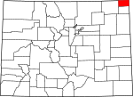
| Yuma County | 125 | Wray | 1889-03-15 | Gesplitst van Washington County. | Genoemd naar de Quechan (Yuma) Nation of Native Americans. | 7004100430000000000♠10,043 | 7003236961000000000♠2,369.61 sq mi |
|
Gerelateerde artikelen
Auteur
AlegsaOnline.com Lijst van provincies in Colorado Leandro Alegsa
URL: https://nl.alegsaonline.com/art/124601
Bronnen
- epa.gov : "EPA County FIPS Code Listing"
- cdphe.state.co.us : "Colorado County Seats"
- naco.org : "NACo - Find a county"
- colorado.gov : "Colorado Government History"
- 2010.census.gov : "2010 United States Census website"