Lijst van provincies in Ohio
Er zijn achtentachtig county's in de Amerikaanse staat Ohio. De gekozen ambtenaren van de county's zijn drie commissarissen, een sheriff (de hoogste wetshandhaver in de county); officier van justitie (het equivalent van een officier van justitie…
Er zijn achtentachtig county's in de Amerikaanse staat Ohio. De gekozen ambtenaren van de county's zijn drie commissarissen, een sheriff (de hoogste wetshandhaver in de county); officier van justitie (het equivalent van een officier van justitie in andere staten); lijkschouwer, ingenieur, accountant, penningmeester en griffier.

| County | FIPS-code | Provincie zetel | Gemaakt | Oorsprong | Betekenis van de naam | Bevolking | Gebied | Kaar |
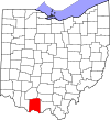
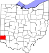
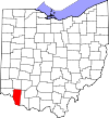
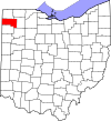
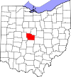
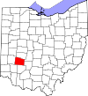
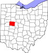
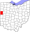
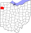
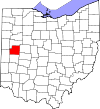
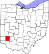
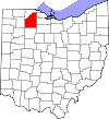
| Adams County | 001 | West-Unie | 10 juli 1797 | Hamilton County | John Adams (1735-1826), tweede president van de VS en bestuurder toen het graafschap werd georganiseerd. | 7004285500000000000♠28,550 | 70025839100000000♠583,91 sq mi |
|
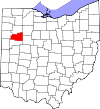
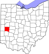
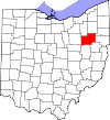
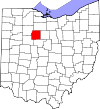
| Allen County | 003 | Lima | 1 maart 1820 | Shelby County | John Allen (1771/2-1813), een kolonel uit de oorlog van 1812. | 7005106331000000000♠106,331 | 7002404430000000000♠404,43 sq mi |
|
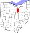
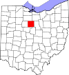
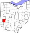
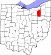
| Ashland County | 005 | Ashland | 24 februari 1846 | Wayne, Richland, Huron, en Lorain Counties | Ashland, huis van U.S. Senator van Kentucky Henry Clay. | 7004531390000000000♠53,139 | 700242437000000♠424,37 sq mi |
|
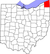
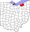
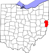
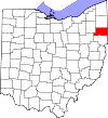
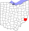
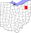
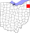
| Ashtabula County | 007 | Jefferson | 7 juni 1807 | Trumbull en Geauga Counties | Ashtabula River, wat "visrivier" betekent in een Algonquian taal | 7005101497000000000♠101,497 | 7002702440000000000♠702,44 sq mi |
|
| Athens County | 009 | Athene | 1 maart 1805 | Washington County | Athene, Griekenland | 7004647570000000000♠64,757 | 700250676000000♠506,76 sq mi |
|
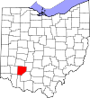
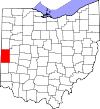
| Auglaize County | 011 | Wapakoneta | 14 februari 1848 | Allen, Mercer, Darke, Hardin, Logan, Shelby en Van Wert Counties... | Auglaize Rivier, wat "gevallen hout rivier" betekent voor de Shawnee | 7004459490000000000♠45,949 | 7002401250000000000♠401,25 sq mi |
|
| Belmont County | 013 | St. Clairsville | 7 september 1801 | Jefferson en Washington Counties | Belle monte, wat "mooie berg" betekent in het Frans | 7004704000000000000♠70,400 | 700253735000000♠537,35 sq mi |
|
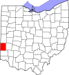
| Brown County | 015 | Georgetown | 1 maart 1818 | Adams en Clermont Counties | Generaal Jacob Brown (1775-1828), een officier uit de oorlog van 1812 | 7004448460000000000♠44,846 | 700249176000000♠491,76 sq mi |
|
| Butler County | 017 | Hamilton | 1 mei 1803 | Hamilton County | Generaal Richard Butler (1743-1791), gedood bij de Slag om de Wabash | 7005368130000000000♠368,130 | 700246727000000♠467,27 sq mi |
|
| Carroll County | 019 | Carrollton | 1 januari 1833 | Columbiana, Stark, Harrison, Jefferson en Tuscarawas Counties... | Charles Carroll (1737-1832), laatste overlevende ondertekenaar van de Onafhankelijkheidsverklaring van de Verenigde Staten. | 7004288360000000000♠28,836 | 7002394670000000000♠394,67 sq mi |
|
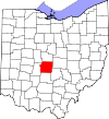
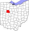
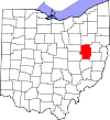
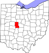
| Champaign County | 021 | Urbana | 1 maart 1805 | Greene en Franklin Counties | Frans voor "een vlakte", waarmee het land in het gebied wordt beschreven | 7004400970000000000♠40,097 | 700242856000000♠428,56 sq mi |
|
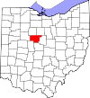
| Clark County | 023 | Springfield | 1 maart 1818 | Champaign, Madison, en Greene Counties | Generaal George Rogers Clark (1752-1818), versloeg de Shawnee indianen in een veldslag bij Springfield. | 7005138333000000000♠138,333 | 7002399860000000000♠399,86 sq mi |
|
| Clermont County | 025 | Batavia | 6 december 1800 | Hamilton County | Frans voor "heldere berg" | 7005197363000000000♠197,363 | 700245199000000♠451,99 sq mi |
|
| Clinton County | 027 | Wilmington | 1 maart 1810 | Highland en Warren Counties | George Clinton (1739-1812), vice-president toen het graafschap werd georganiseerd. | 7004420400000000000♠42,040 | 700241088000000♠410,88 sq mi |
|
| Columbiana County | 029 | Lissabon | 1 mei 1803 | Jefferson en Washington Counties | Afgeleid van de woorden Christoffel Columbus, Europees ontdekkingsreiziger van Amerika... | 7005107841000000000♠107,841 | 700253246000000♠532,46 sq mi |
|
| Coshocton County | 031 | Coshocton | 31 januari 1810 | Muskingum en Tuscarawas Counties | Delaware Indiaans woord dat "vereniging van wateren" betekent. | 7004369010000000000♠36,901 | 700256407000000♠564,07 sq mi |
|
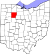
| Crawford County | 033 | Bucyrus | 1 april 1820 | Delaware County | Kolonel William Crawford (1732-1782), officier in de Revolutionaire Oorlog. | 7004437840000000000♠43,784 | 700240211000000♠402,11 sq mi |
|
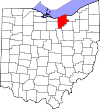
| Cuyahoga County | 035 | 7 juni 1807 | Geauga County | Cuyahoga rivier, wat "kromme rivier" betekent in een Iroquoiaanse taal. | 7006128012200000000♠1,280,122 | 7002458490000000000♠458,49 sq mi |
| |
| Darke County | 037 | Greenville | 3 januari 1809 | Miami County | Generaal William Darke (1736-1801), officier in de Revolutionaire Oorlog. | 7004529590000000000♠52,959 | 700259979000000♠599,80 sq mi |
|
| Defiance County | 039 | Defiance | 7 april 1845 | Williams, Henry en Paulding Counties | Fort Defiance, gebouwd in 1794 door Generaal Anthony Wayne | 7004390370000000000♠39,037 | 7002411160000000000♠411,16 sq mi |
|
| Delaware County | 041 | Delaware | 1 april 1808 | Franklin County | Delaware Indianen | 7005174214000000000♠174,214 | 7002442410000000000♠442,41 sq mi |
|
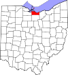
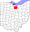
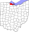
| Erie County | 043 | Sandusky | 15 maart 1838 | Huron en Sandusky Counties | Erie Indianen | 7004770790000000000♠77,079 | 700225488000000♠254,88 sq mi |
|
| Fairfield County | 045 | Lancaster | 9 december 1800 | Ross en Washington Counties | Genoemd naar de schoonheid van zijn "eerlijke velden". | 7005146159000000000♠146,159 | 700250511000000♠505,11 sq mi |
|
| Fayette County | 047 | Hof van Washington | 1 maart 1810 | Ross en Highland Counties | Markies de Lafayette, Frans militair en aristocraat die deelnam aan zowel de Amerikaanse als de Franse revolutie. | 7004290300000000000♠29,030 | 7002406580000000000♠406,58 sq mi |
|
| Franklin County | 049 | 30 april 1803 | Ross en Wayne Counties | Benjamin Franklin (1706-1791) - Founding Father, schrijver, drukker, satiricus, politiek theoreticus, wetenschapper, uitvinder en staatsman. | 7006116341400000000♠1,163,414 | 7002539870000000000♠539,87 sq mi |
| |
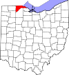
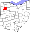
| Fulton County | 051 | Wauseon | 1 april 1850 | Lucas, Henry en Williams Counties | Robert Fulton (1765-1815), uitvinder van de stoomboot | 7004426980000000000♠42,698 | 70024067899900000♠406,78 sq mi |
|
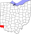
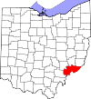
| Gallia County | 053 | Gallipolis | 30 april 1803 | Washington en Adams Counties | Gaul, de oude naam van Frankrijk | 7004309340000000000♠30,934 | 7002468780000000000♠468,78 sq mi |
|
| Geauga County | 055 | Chardon | 1 maart 1806 | Trumbull County | Een indiaans woord dat "wasbeer" betekent. | 7004933890000000000♠93,389 | 7002403660000000000♠403,66 sq mi |
|
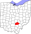
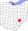
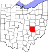
| Greene County | 057 | Xenia | 1 mei 1803 | Hamilton en Ross Counties | Generaal Nathanael Greene (1742-1786), officier in de Revolutionaire Oorlog. | 7005161573000000000♠161,573 | 700241488000000♠414,88 sq mi |
|
| Guernsey County | 059 | Cambridge | 1 maart 1810 | Belmont en Muskingum Counties | Het eiland Guernsey, waar de meeste kolonisten vandaan kwamen... | 7004400870000000000♠40,087 | 7002521900000000000♠521,90 sq mi |
|
| Hamilton County | 061 | Cincinnati | 2 januari 1790 | Een van de oorspronkelijke provincies | Alexander Hamilton (1755/7-1804), minister van Financiën toen het graafschap werd opgericht. | 7005802374000000000♠802,374 | 700240736000000♠407,36 sq mi |
|
| Hancock County | 063 | Findlay | 1 april 1820 | Logan County | John Hancock (1737-1793), voorzitter van het Continentaal Congres | 7004747820000000000♠74,782 | 700253135000000♠531,35 sq mi |
|
| Hardin County | 065 | Kenton | 1 april 1820 | Logan County | Generaal John Hardin (1753-1792), officier in de Revolutionaire Oorlog. | 7004320580000000000♠32,058 | 7002470290000000000♠470,29 sq mi |
|
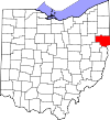
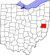
| Harrison County | 067 | Cadiz | 1 februari 1813 | Jefferson en Tuscarawas Counties | Generaal William Henry Harrison (1773-1841), officier in de oorlog van 1812 en toekomstig president van de VS. | 7004158640000000000♠15,864 | 70024035399900000♠403,53 sq mi |
|
| Henry County | 069 | Napoleon | 1 april 1820 | Shelby County | Patrick Henry (1736-1799), revolutionair wetgever, redenaar en geleerde. | 7004282150000000000♠28,215 | 7002416500000000000♠416,50 sq mi |
|
| Highland County | 071 | Hillsboro | 1 mei 1805 | Ross, Adams, en Clermont Counties | Beschrijft het terrein van de provincie | 7004435890000000000♠43,589 | 7002553280000000000♠553,28 sq mi |
|
| Hocking County | 073 | Logan | 1 maart 1818 | Athens, Ross, en Fairfield Counties | Mogelijk afgeleid van het Delaware Indiaanse woord "Hoch-Hoch-ing", wat "fles" betekent. | 7004293800000000000♠29,380 | 7002422750000000000♠422,75 sq mi |
|
| Holmes County | 075 | Millersburg | 20 januari 1824 | Coshocton, Wayne, en Tuscarawas Counties | Majoor Andrew Holmes (geb. 1814), een officier uit de oorlog van 1812. | 7004423660000000000♠42,366 | 700242299000000♠422,99 sq mi |
|
| Huron County | 077 | Norwalk | 7 maart 1809 | Portage en Cuyahoga Counties | Huron Indianen | 7004596260000000000♠59,626 | 7002492690000000000♠492,69 sq mi |
|
| Jackson County | 079 | Jackson | 1 maart 1816 | Scioto, Gallia, Athens, en Ross Counties | Generaal Andrew Jackson (1767-1845) | 7004332250000000000♠33,225 | 70024202899900000♠420,28 sq mi |
|
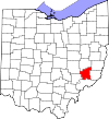
| Jefferson County | 081 | Steubenville | 29 juli 1797 | Washington County | Thomas Jefferson (1743-1826), vicepresident toen het graafschap werd opgericht, toekomstig president van de VS en voornaamste auteur van de Onafhankelijkheidsverklaring. | 7004697090000000000♠69,709 | 70024096100000000♠409,61 sq mi |
|
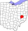
| Knox County | 083 | Mount Vernon | 1 maart 1808 | Fairfield County | Generaal Henry Knox, de eerste minister van oorlog... | 7004609210000000000♠60,921 | 700252712000000♠527,12 sq mi |
|
| Lake County | 085 | Painesville | 6 maart 1840 | Geauga en Cuyahoga Counties | Zo genoemd omdat het aan het Eriemeer grenst. | 7005230041000000000♠230,041 | 700222821000000♠228,21 sq mi |
|
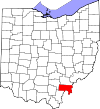
| Lawrence County | 087 | Ironton | 21 december 1815 | Gallia en Scioto Counties | Kapitein James Lawrence (1781-1813), zeeheld in de oorlog van 1812. | 7004624500000000000♠62,450 | 7002454960000000000♠454,96 sq mi |
|
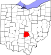
| Licking County | 089 | Newark | 1 maart 1808 | Fairfield County | Genoemd naar de zoutpannen in het gebied | 7005166492000000000♠166,492 | 7002686500000000000♠686,50 sq mi |
|
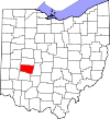
| Logan County | 091 | Bellefontaine | 1 maart 1818 | Champaign County | Generaal Benjamin Logan (ca. 1742-1802), die Shawnee Indianensteden in het graafschap verwoestte. | 7004458580000000000♠45,858 | 700245844000000♠458,44 sq mi |
|
| Lorain County | 093 | Elyria | 26 december 1822 | Huron, Cuyahoga, en Medina Counties | Provincie Lotharingen, Frankrijk | 7005301356000000000♠301,356 | 7002492500000000000♠492,50 sq mi |
|
| Lucas County | 095 | 20 juni 1835 | Wood, Sandusky, en Huron Counties | Robert Lucas (1781-1853), gouverneur van Ohio toen het graafschap werd opgericht. | 7005441815000000000♠441,815 | 700234046000000♠340,46 sq mi |
| |
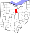
| Madison County | 097 | Londen | 1 maart 1810 | Franklin County | James Madison (1751-1836), vierde president van de V.S. | 7004434350000000000♠43,435 | 700246544000000♠465,44 sq mi |
|
| Mahoning County | 099 | 1 maart 1846 | Columbiana en Trumbull Counties | Mahoning River, van een Indiaans woord dat "bij de licks" betekent. | 7005238823000000000♠238,823 | 700241525000000♠415,25 sq mi |
| |
| Marion County | 101 | Marion | 1 april 1820 | Delaware County | Generaal Francis Marion (1732-1795), luitenant-kolonel in het Continentaal Leger en later brigadegeneraal in de Amerikaanse Revolutionaire Oorlog. | 7004665010000000000♠66,501 | 70024038499900000♠403,84 sq mi |
|
| Medina County | 103 | Medina | 18 februari 1812 | Portage County | Medina, wereldberoemde religieuze plaats en hoofdstad van de provincie Al Madinah in het westen van Saoedi-Arabië. | 7005172332000000000♠172,332 | 7002421550000000000♠421,55 sq mi |
|
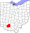
| Meigs County | 105 | Pomeroy | 1 april 1819 | Gallia en Athens Counties | Jonathan Meigs, Jr. (1764-1825), gouverneur van Ohio en postmeester-generaal ten tijde van de organisatie van het district. | 7004237700000000000♠23,770 | 70024294200000000♠429,42 sq mi |
|
| Mercer County | 107 | Celina | 1 april 1820 | Darke County | Generaal Hugh Mercer (1726-1777), een officier uit de Revolutionaire Oorlog. | 7004408140000000000♠40,814 | 700246327000000♠463,27 sq mi |
|
| Miami County | 109 | Troy | 1 maart 1807 | Montgomery County | Miami Indians | 7005102506000000000♠102,506 | 7002407040000000000♠407,04 sq mi |
|
| Monroe County | 111 | Woodsfield | 29 januari 1813 | Belmont, Washington en Guernsey Counties | James Monroe (1758-1831), staatssecretaris toen het graafschap werd opgericht en toekomstig president van de V.S. | 7004146420000000000♠14,642 | 700245554000000♠455,54 sq mi |
|
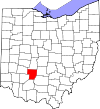
| Montgomery County | 113 | Dayton | 1 mei 1803 | Hamilton en Wayne Counties | Generaal Richard Montgomery (1738-1775), een officier uit de Revolutionaire Oorlog. | 7005535153000000000♠535,153 | 7002461680000000000♠461,68 sq mi |
|
| Morgan County | 115 | McConnelsville | 29 december 1817 | Washington, Guernsey en Muskingum Counties | Generaal Daniel Morgan (ca. 1735-1802), een officier uit de Revolutionaire Oorlog. | 7004150540000000000♠15,054 | 700241766000000♠417,66 sq mi |
|
| Morrow County | 117 | Mount Gilead | 1 maart 1848 | Knox, Marion, Delaware en Richland Counties... | Jeremiah Morrow (1771-1852), gouverneur van Ohio | 7004348270000000000♠34,827 | 700240622000000♠406,22 sq mi |
|
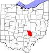
| Muskingum County | 119 | Zanesville | 1 maart 1803 | Washington en Fairfield Counties | Een Indiaans woord dat "Een stad bij de rivier" betekent... | 7004860740000000000♠86,074 | 7002664630000000000♠664,63 sq mi |
|
| Noble County | 121 | Caldwell | 1 april 1851 | Monroe, Washington, Morgan, en Guernsey Counties | James Noble (1785-1831), een vroege kolonist en toekomstig Amerikaans senator uit Indiana. | 7004146450000000000♠14,645 | 7002399000000000000♠399,00 sq mi |
|
| Ottawa County | 123 | Port Clinton | 6 maart 1840 | Erie, Sandusky, en Lucas Counties | Genoemd naar de Ottawa-indianen; Ottawa betekent "handelaar" in hun taal. | 7004414280000000000♠41,428 | 7002254950000000000♠254,95 sq mi |
|
| Paulding County | 125 | Paulding | 1 april 1820 | Darke County | John Paulding (1758-1818), gevangene van spion John André tijdens de Revolutionaire Oorlog | 7004196140000000000♠19,614 | 700241626000000♠416,26 sq mi |
|
| Perry County | 127 | Nieuw Lexington | 1 maart 1818 | Washington, Fairfield, en Muskingum Counties | Commodore Oliver Hazard Perry (1785-1819), marineofficier in de oorlog van 1812. | 7004360580000000000♠36,058 | 70024097899900000♠409,78 sq mi |
|
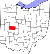
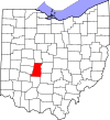
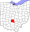
| Pickaway County | 129 | Circleville | 1 maart 1810 | Ross, Fairfield, en Franklin Counties | Een verkeerde spelling van de Piqua-stam, een tak van de Shawnee | 7004556980000000000♠55,698 | 70025019100000000♠501,91 sq mi |
|
| Pike County | 131 | Waverly | 1 februari 1815 | Ross, Scioto, en Adams Counties | Generaal Zebulon M. Pike (1779-1813), officier in de Revolutionaire Oorlog en ontdekker van Pikes Peak in Colorado in 1806. | 7004287090000000000♠28,709 | 700244149000000♠441,49 sq mi |
|
| Portage County | 133 | Ravenna | 7 juni 1807 | Trumbull County | Afgeleid van een Indiaanse oversteekplaats | 7005161419000000000♠161,419 | 700249239000000♠492,39 sq mi |
|
| Preble County | 135 | Eaton | 1 maart 1808 | Montgomery en Butler Counties | Kapitein Edward Preble (1761-1807), marinecommandant in de Revolutionaire Oorlog. | 7004422700000000000♠42,270 | 70024248000000000♠424,80 sq mi |
|
| Putnam County | 137 | Ottawa | 1 april 1820 | Shelby County | Generaal Israel Putnam (1718-1790), een officier uit de Revolutionaire Oorlog. | 7004344990000000000♠34,499 | 700248387000000♠483,87 sq mi |
|
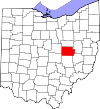
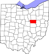
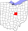
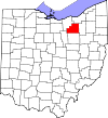
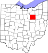
| Richland County | 139 | Mansfield | 1 maart 1808 | Fairfield County | Beschrijving van de bodem in het gebied | 7005124475000000000♠124,475 | 700249688000000♠496,88 sq mi |
|
| Ross County | 141 | Chillicothe | 20 augustus 1798 | Adams en Washington Counties | Genoemd naar U.S. Senator uit Pennsylvania James Ross door gouverneur Arthur St. Clair. | 7004780640000000000♠78,064 | 700268841000000♠688,41 sq mi |
|
| Sandusky County | 143 | Fremont | 1 april 1820 | Huron County | Een Iroquois woord dat "koud water" betekent. | 7004609440000000000♠60,944 | 700240918000000♠409,18 sq mi |
|
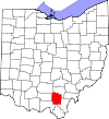
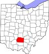
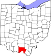
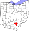
| Scioto County | 145 | Portsmouth | 1 mei 1803 | Adams County | Scioto rivier; Scioto is een Wyandot woord dat "hert" betekent. | 7004794990000000000♠79,499 | 700261227000000♠612,27 sq mi |
|
| Seneca County | 147 | Tiffin | 1 april 1820 | Huron County | Seneca Indianen, die toen een reservaat hadden in het gebied van het graafschap... | 7004567450000000000♠56,745 | 700255059000000♠550,59 sq mi |
|
| Shelby County | 149 | Sidney | 1 april 1819 | Miami County | Generaal Isaac Shelby (1750-1826), officier in de Revolutionaire Oorlog en gouverneur van Kentucky, | 7004494230000000000♠49,423 | 700240927000000♠409,27 sq mi |
|
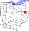
| Stark County | 151 | Canton | 13 februari 1808 | Columbiana County | Generaal John Stark (1728-1822), een officier uit de Revolutionaire Oorlog; bekend als de "Held van Bennington" voor zijn voorbeeldige dienst in de Slag bij Bennington in 1777. | 7005375586000000000♠375,586 | 700257614000000♠576,14 sq mi |
|
| Summit County | 153 | Akron | 3 maart 1840 | Medina, Portage, en Stark Counties | Afgeleid van de hoogste ligging langs het Ohio kanaal. | 7005541781000000000♠541,781 | 7002412720000000000♠412,72 sq mi |
|
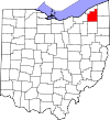
| Trumbull County | 155 | Warren | 10 juli 1800 | Jefferson en Wayne Counties | Jonathan Trumbull (1710-1785), gouverneur van Connecticut toen het graafschap werd georganiseerd. | 7005210312000000000♠210,312 | 700261648000000♠616,48 sq mi |
|
| Tuscarawas County | 157 | Nieuw Philadelphia | 15 maart 1808 | Muskingum County | Tuscarawas River, wat "open mond rivier" betekent. | 7004925820000000000♠92,582 | 700256758000000♠567,58 sq mi |
|
| Union County | 159 | Marysville | 1 april 1820 | Delaware, Franklin, Logan, en Madison Counties | Zo genoemd omdat het gevormd is door een vereniging van vier graafschappen. | 7004523000000000000♠52,300 | 700243665000000♠436,65 sq mi |
|
| Van Wert County | 161 | Van Wert | 1 april 1820 | Darke County | Isaac Van Wart (1760-1828), gevangene van spion John André tijdens de Revolutionaire Oorlog. | 7004287440000000000♠28,744 | 70024100999900000♠410,09 sq mi |
|
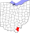
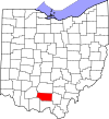
| Vinton County | 163 | McArthur | 23 maart 1850 | Athens, Gallia, Hocking, Jackson en Ross Counties... | Samuel Finley Vinton (1792-1862), staatsman uit Ohio en Amerikaans congreslid. | 7004134350000000000♠13,435 | 7002414080000000000♠414,08 sq mi |
|
| Warren County | 165 | Libanon | 1 mei 1803 | Hamilton County | Generaal Joseph Warren (1741-1775), een officier uit de Revolutionaire Oorlog. | 7005212693000000000♠212,693 | 7002399630000000000♠399,63 sq mi |
|
| Washington County | 167 | Marietta | 27 juli 1788 | Een van de oorspronkelijke provincies | George Washington (1732-1799), bevelhebber van het Continentaal Leger, voorzitter van de Constitutionele Conventie en toekomstig president van de VS. | 7004617780000000000♠61,778 | 700263515000000♠635,15 sq mi |
|
| Wayne County | 169 | Wooster | 1 maart 1808 | Van niet-gemeentelijk gebied | Generaal Anthony Wayne (1745-1796), een officier uit de Revolutionaire Oorlog. | 7005114520000000000♠114,520 | 700255536000000♠555,36 sq mi |
|
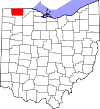
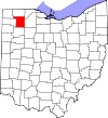
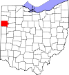
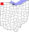
| Williams County | 171 | Bryan | 1 april 1820 | Darke County | David Williams (1754-1831), gevangene van spion John André tijdens de Revolutionaire Oorlog | 7004376420000000000♠37,642 | 700242174000000♠421,74 sq mi |
|
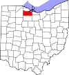
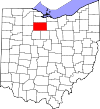
| Wood County | 173 | Bowling Green | 1 april 1820 | Geherformuleerd van niet-landelijk gebied | Eleazer D. Wood (1783 -1814), stichter van Fort Meigs | 7005125488000000000♠125,488 | 700261732000000♠617,32 sq mi |
|
| Wyandot County | 175 | Upper Sandusky | 3 februari 1845 | Marion, Crawford, en Hardin Counties | Wyandot Indianen | 7004226150000000000♠22,615 | 7002405610000000000♠405,61 sq mi |
|


Gerelateerde artikelen
Auteur
AlegsaOnline.com Lijst van provincies in Ohio Leandro Alegsa
URL: https://nl.alegsaonline.com/art/124626
Bronnen
- epa.gov : "EPA County FIPS Code Listing"
- naco.org : "NACo - Find a County"
- sos.state.oh.us : "Federal Roster: Counties of Ohio, Derivation of Name and Date of Erection"
- rootsweb.com : "Ohio Genealogy Clickable County Map" · web.archive.org
- britannica.com : Ashtabula
- britannica.com : Cuyahoga River
- books.google.com : History of Ohio: From the Glacial Period to the Present Time
- publications.ohiohistory.org : "The Evolution of Ohio Counties"